1195 Hope St
San Jose, CA 95002
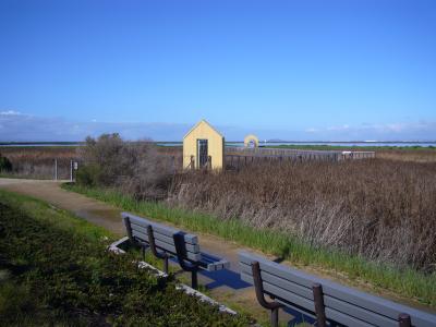
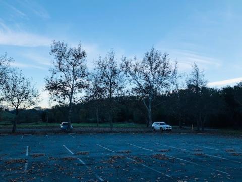
No parking fee, but limited parking inside the lot. Overflow parking available on Hope Street. The Alviso Slough Trail is flat, and creates an approximately 2.6 mile loop around the wildlife refuge. Dogs are not permitted on the trail. Bicyclists are allowed on the trail but need to walk their bicycles on any boardwalks. The trail is excellent for viewing wildlife and is subject to extreme weather. No swimming or fishing from the shoreline is permitted. Alviso Marina’s launch ramp is utilized by non-power vessels like kayaks and power vessels. Fishing is permitted from a vessel. Seasonally, hunting is permitted in designated ponds. The parking lot closes at sunset. Hunters and fishermen can purchase an annual after-hours key card by contacting Park Reservations at 408-355-2201. It is important to always keep track of the tide levels when launching at Alviso Marina, tide charts are available on-site and online. The park is not a good location to walk your dog due to being restricted to only the parking lot and the picnic sites.
Meeting Location
Latitude: 37.4298373
Longitude: -121.9797212
The address below is for the Alviso Marina County park entrance.
19245 Malaguerra Ave
Morgan Hill, CA 95037
Meeting Location
Latitude: 37.1655
Longitude: -121.6265
The address below is for the Anderson Lake County park entrance.
19245 Malaguerra Ave
Morgan Hill, CA 95037
Meeting Location
Latitude: 37.166923
Longitude: -121.64957
The address below is for the Anderson Lake County park entrance.
19245 Malaguerra Ave
Morgan Hill, CA 95037
Meeting Location
Latitude: 37.1643
Longitude: -121.6271
The address below is for the Anderson Lake County park entrance.
21350 Almaden Rd
San Jose, CA 95120
Meeting Location
Latitude: 37.178623
Longitude: -121.819511
The address below is for Casa Grande - Almaden Quicksilver Mining Museum.
21785 Almaden Rd
San Jose, CA 95120
Hacienda Entrance
Almaden Quicksilver's signature entrance features the iconic New Almaden bell tower and outdoor mining museum in the parking lot of the Hacienda Entrance. The Hacienda Entrance offers two major trailheads: the Mine Hill Trail and Deep Gulch Trail. Enter the Mine Hill Trail, a fireroad once used to access the quicksilver mines throughout what is now the 4,163 acre county park. The Mine Hill Trail is a moderate 6.5 mile trail, which can be used to access many of the cultural sites throughout the park, and major thoroughfare connecting the Hacienda Entrance, the southernmost entrance of the park, to the McAbee Road Entrance, the northernmost entrance of the park. The Hacienda Entrance also features the Deep Gulch Trail, a 1.2 mile trail through the canyon to the south of the Mine Hill Trail. Deep Gulch is a lightly trafficked hidden gem, and although shaded year round, is rated as difficult due to its steep ascent. Make sure to grab a historic map at the trailhead and visit 15 cultural sites along a 6.5 mile loop that takes you through the most sought after historical sites in the park
Latitude: 37.173845
Longitude: -121.825213
The address below is for the Almaden Quicksilver park entrance.
21785 Almaden Rd
San Jose, CA 95120
The Mockingbird Hill Entrance, once known as an Equestrian entrance, features three major trailheads: The Virl O’ Norton Trail, The New Almaden Trail and the Hacienda Trail; as well as multiple picnic areas. Follow the Virl O' Norton Trail along a 3.6 mile loop, capped with a stunning vista of the Almaden Valley, near the end of this hike. This loop has been featured on Santa Clara County's Pix-in-Parks Challenge! Another option for the less adventurous hiker is to follow the Hacienda Trail .6 miles to the vista. Don't forget to take a picture and post it with the tag #AlmadenQuicksilver. Both the Virl O' Norton Trail and the Hacienda trail are rated as moderate to difficult. The Virl O' Norton Trail allows Mountain Bikers and Equestrians access to the rest of Almaden Quicksilver by way of the Capehorn Pass Trail. The Hacienda Trail does not allow bicycles or equestrians due to its steep and rocky descent.
Latitude: 37.1937
Longitude: -121.8368
The address below is for the Almaden Quicksilver park entrance.
21785 Almaden Rd
San Jose, CA 95120
Meeting Location
Latitude: 37.178623
Longitude: -121.819511
The address below is for the Almaden Quicksilver park entrance.
Wood Rd. Trail
San Jose, CA 95120
The Woods Road Entrance is a lightly used, rural entrance to Almaden Quicksilver off of Hicks Road featuring its namesake trail, the Woods Road Trail. The Woods Road Trail is a 1.3 mile trail which gives the Hiker, Mountain Biker or Equestrian expansive views of the Sierra Azul Mountain Range, Mt. Umunhum and the Almaden Reservoir down below. The crown jewel of the Woods Road Trail is the historic Rotary Furnace, the second most sought after cultural site in the park after English Camp. The Woods Road Trail is rated as easy, and can be utilized as a 2.6 mile out and back trail (round trip,) or as a connector to various historical sites throughout the park including English Camp, the Hidalgo Cemetery, San Cristobal Mine, or the Bull Run Vista point.
Latitude: 37.1754
Longitude: -121.862
This entrance does not have a physical address.
23205 McKean Rd
San Jose, CA 95120
Meeting Location
Latitude: 37.174763
Longitude: -121.76075
The address below is for the Calero County park entrance.
23205 McKean Rd
San Jose, CA 95120
Meeting Location
Latitude: 37.1755
Longitude: -121.7613
The address below is for the Calero County park entrance.
23205 McKean Rd
San Jose, CA 95120
Meeting Location
Latitude: 37.19451
Longitude: -121.8073117
The address below is for the Calero County park entrance.
23205 McKean Rd
San Jose, CA 95120
Meeting Location
Latitude: 37.1871
Longitude: -121.7749
The address below is for the Calero County park entrance.
Monterey Rd
San Jose, CA 95138
Meeting Location
Latitude: 37.229411
Longitude: -121.756514
Closest cross is Monterey Hwy and Metcalf Road.
8160 Monterey Rd
Coyote, CA 95013
Meeting Location
Latitude: 37.257559
Longitude: -121.790525
The address below is for the Coyote Creek park entrance.
Calaveras Trail
Gilroy, CA 95020
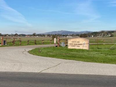
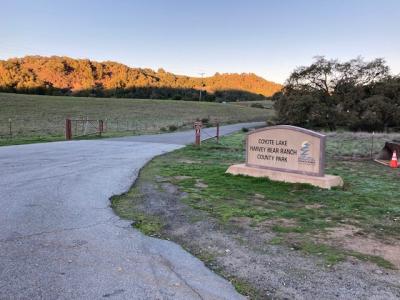
The boat launch parking lot is where to park to go into the entrance across from the boat lot.
The Valley Oak or the Calaveras Trail provide for good hiking. Blue Oak traverses both sides of the mountain, east and west. There is a RR available, 6 $ fee and both trails listed are mostly shaded.
Meeting Location
Latitude: 37.092751
Longitude: -121.542023
The address below is for the Coyote Lake Harvey Bear Ranch park entrance.
Calaveras Trail
Gilroy, CA 95020
We do movies here and interpretive programs during the summer season. Located at the back of the RV campground.
Meeting Location
Latitude: 37.0798838
Longitude: -121.5306892
The address below is for the Coyote Lake Harvey Bear Ranch park entrance.
Calaveras Trail
Gilroy, CA 95020
Meeting Location
Latitude: 37.081255
Longitude: -121.531067
The address below is for the Coyote Lake Harvey Bear Ranch park entrance.
Calaveras Trail
Gilroy, CA 95020
6$ entrance, not recommended for trailers. 3 miles past the ranger station.
Ed Willson is a great trail to go on from here and the Calaveras and Valley Oak Trail. Fishing is accessible and there is a porto available.
Meeting Location
Latitude: 37.117632
Longitude: -121.551195
The address below is for the Coyote Lake Harvey Bear Ranch park entrance.
Calaveras Trail
Gilroy, CA 95020
No cost, Martin Murphy Trail 2-mile paved trail access: Parking and access to the western portion of the park. The western side of the park is more exposed to the sun, the Coyote Ridge trail somewhat aligns itself as the actual ridge line, it delignates the shadier side of the park (eastern side) and more exposed portion of the park (western side).
The entrance is located on E San Martin Ave, I do not believe that it has an actual address associated with it. 101 S, exit San Martin Ave, go east. Lots of parking, horse trailer parking. Dirt trails are subject to closure after excessive rains, paved trail remains open. Only porto RR available.
Meeting Location
Latitude: 37.096803
Longitude: -121.577346
The address below is for the Coyote Lake Harvey Bear Ranch park entrance.
Calaveras Trail
Gilroy, CA 95020
Some horse trailer parking and moderate amounts of vehicle parking, subject to filling up on weekend days. Porto RR available. Great hikes include the Mummy Mt Trail. – Coyote Ride Loop or add a Valley Oak Loop for extra mileage. No fees. There is fishing at the Roop Pond which is close, parking only available here.
Meeting Location
Latitude: 37.069972
Longitude: -121.520235
The address below is for the Coyote Lake Harvey Bear Ranch park entrance.
Calaveras Trail
Gilroy, CA 95020
Across from Lakeview campground: 6$ entrance, 10840 Coyote Lake Rd is the entrance, parking
available at the RV camp entrance. Not a horse entrance, the trail itself leads to the Valley Oak Trail, several loops available.
Meeting Location
Latitude: 37.080497
Longitude: -121.531244
The address below is for the Coyote Lake Harvey Bear Ranch park entrance.
10840 Coyote Lake Road
Gilroy, CA 95020
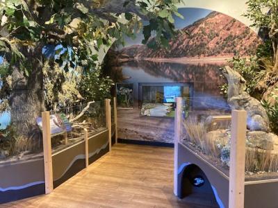
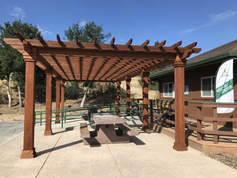
There is a newly remolded park visitor venter with a diorama of local wildlife.
Not a parking area for the trails.
Meeting Location
Latitude: 37.079
Longitude: -121.527
The address below is for the Coyote Lake Harvey Bear Ranch park entrance.
3100 Calaveras Rd
Milpitas, CA 95035
Meeting Location
Latitude: 37.4477371983999
Longitude: -121.848407646
The address below is for Ed R. Levin County Park entrance
1 Downing Road
Milpitas, CA 95035
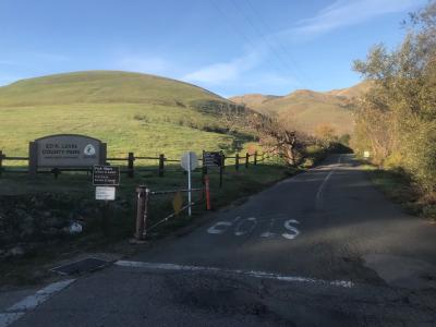
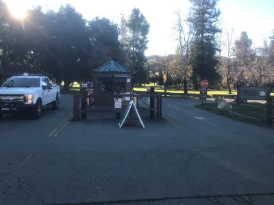
$6 parking fee. Great for picnicking and views of the valley. Access point to the City of Milpitas Off-leash Dog Park, Sandy Wool Lake, Elm Playground, and the Hang/Para-gliding recreational areas. Dogs must be on leash when outside of the Dog Park. Fishing is permitted at Sandy Wool Lake with a valid CA fishing license, barbless hooks, and no live bait. No swimming is allowed. The trails that can be accessed here are: Tularcitos, Calaveras Ridge, Agua Caliente, Monument Peak, Elm, Sandy Wool, and Calera Creek. Mountain Bicyclists are only allowed on the Bay Area Ridge Trail System, which includes sections of Calera Creek and Agua Caliente. Cattle graze this side of the park, so please close all gates behind yourself and you should never have to climb over or under any gate. If you do, then you’re likely in a closed area.
Meeting Location
Latitude: 37.4521
Longitude: -121.86
The address below is for Ed R. Levin County Park entrance
3100 Calaveras Rd
Milpitas, CA 95035
$6 parking fee. Great for picnicking. Access point to the visitor center, Spring Valley Pond, Laguna Cemetery Historical Monument, and equestrian parking.
Spring Valley is a favorite first-time fishing hole for children ages 5-12. No swimming is allowed. The 18-hole Spring Valley Golf Course and Airpoint Trail is just north across Calaveras Road. Dogs must be on leash and dogs are not allowed on the dirt trails south of Calaveras Road. The trails that are south of Calaveras Road and that can be accessed here are: Spring Valley, Los Coches Ridge, and the Nature Trail. Equestrians are common on this side of the park and must clean up any horse droppings. For horseback riding lessons, you can contact the concessionaire, Chaparral at 408-726-8453.
Meeting Location
Latitude: 37.4479
Longitude: -121.8487
The address below is for Ed R. Levin County Park entrance
985 Hellyer Ave
San Jose, CA 95111
Meeting Location
Latitude: 37.288101440638385,
Longitude: -121.80985903299208
The address below is for Hellyer County Park entrance
855 Coyote Road
San Jose, CA 95111
Learn more about disc golf at this following website:
Parque De La Raza Disc Golf Course | Professional Disc Golf Association (pdga.com)
Meeting Location
Latitude: 37.2771268453999
Longitude: -121.803752728
985 Hellyer Ave
San Jose, CA 95111
Meeting Location
Latitude: 37.2822
Longitude: -121.8118
The address below is for Hellyer County Park entrance
985 Hellyer Ave
San Jose, CA 95111
Welcome to Hellyer County Park Velodrome, Northern California’s only dedicated bicycle racing facility. The velodrome, operated within Santa Clara County’s Hellyer Park, has offered bike racing opportunities for beginner through world-class racers since 1963.
The velodrome is located in Hellyer County Park and is administered by the NCVA (Northern California Velodrome Association).The NCVA strives to promote the sport of track cycling by offering diversified racing programs, developing athletes, providing healthy fitness programs for the community and bringing world-class track racing to the Northern California area. As the only velodrome in Northern California, they have a unique opportunity to attract championship cycling events and international racers, build a compelling race series and groom tomorrow’s Olympians.
The Hellyer County Park Velodrome was built in 1963 for an original investment of $25,000. Located in Hellyer County Park in San
Jose, the velodrome is part of the Hellyer Park and the Coyote Creek Parkway; a 354-acre urban park in the heart of Santa Clara
County’s regional park system. Today, Hellyer stands as the only velodrome in existence within Northern California.
Further details about the track, including directions and other detailed information, can be found at http://www.ridethetrack.com
Meeting Location
Latitude: 37.2883
Longitude: -121.8122
The address below is for Hellyer County Park entrance
985 Hellyer Ave
San Jose, CA 95111
Meeting Location
Latitude: 37.284750746
Longitude: -121.811062449999
The address below is for Hellyer County Park entrance
Yerba Buena Trail
San Jose, CA 95127
Meeting Location
Latitude: 37.34255
Longitude: -121.71587
Grant Lake parking lot is located at Joseph D Grant County Park. Parking is free and first come first serve and there is one restroom. The parking lot allows park visitors access to Lake View Trail, McCreary Lake, Halls Valley trail, and Los Huecos Trail. Lake view trail is an easy walk with nice views and if one is lucky, one can watch a pair of bald eagles that frequent the lake in the winter months.
The address below is for the Joseph D. Grant park entrance.
Yerba Buena Trail
San Jose, CA 95127
Meeting Location
Latitude: 37.33778
Longitude: -121.7146091
The address below is for the Joseph D. Grant park entrance.
Deer Valley - Joseph D. Grant County Park
Located in the Mt. Hamilton foothills, Joseph D. Grant County Park (Grant Park) is a 9,560-acre park containing numerous recreational resources, interpretive sites, cultural and historic structures. The park is rich in environmental, cultural and archaeological resources and is designated as a California Point of Interest (SCL-049 Joseph D. Grant Ranch at Hall’s Valley).
Grant Park comprises almost two-thirds of the original Rancho Canada de Pala which was a large mountainous ranch established through a land grant in 1839 by Governor Alvarado. Occupied as early as 1835, the Grant family began to acquire former Canada de Pala rancho lands in the 1880s. By 1911 Joseph D. Grant owned much of the southern portion of the rancho, a strip of land along the western side and the north end of Hall’s valley. The remainder of the central portion of the rancho was owned by the Tierman family and by Frank Hubbard. In the 1930’s, Joseph Grant acquired Frank Hubbard’s holdings. After the death of Joseph Grant in 1942 and his wife Edith in 1946, the ranch was left to their children. Josephine Grant McCreery bought out her siblings’ interest in the ranch and resided in the main ranch house from 1958 until her death in 1972. She willed half the ranch to the Save the Redwoods League and half to the Menninger Foundation. Both organizations sold their portion of the ranch in 1975 to the County of Santa Clara, and Joseph D. Grant Park was dedicated and opened to the public in 1978.
Joseph D. Grant County Park Master Plan
The County Parks Department completed a Master Plan for Joseph D. Grant County Park in July, 1993 which was approved by the County Board of Supervisors. The Master Plan provides guidelines for future uses of the historic and non-historic structures and required infrastructure improvements, as well as cultural resource management of the historic structures. As outlined in the Master Plan, ‘cultural/historic inventories, evaluations, and an application for official State and National Register Historic Designation (to determine their historic significance) should be completed prior to preservation work or demolition of any of the cultural resources”. The Joseph D. Grant County Park Master Plan, July 1993 is available on this website.
Grant Ranch House Complex
The most prominent historical structures in Grant Park are contained in the Grant Ranch House Complex (Grant Ranch Complex). The Grant Ranch Complex structures are listed in the County of Santa Clara Historic Resources Inventory and may be eligible for State and/or Federal historic designation.
The Grant Ranch Complex consists of five main structures grouped around a courtyard, surrounding landscape features including brick walls and a rose garden, and two associated structures. The structures date from the late 19th century and early 20th century and represent a period of construction, additions, and modifications undertaken by Joseph D. Grant during his family’s tenure at Grant Ranch from 1927 to 1972. The main ranch house, (Hubbard house), was originally constructed by Adam Hubbard circa 1881, and remodeled and expanded by Joseph D. Grant in the 1930’s.
The Grant Ranch Complex structures include:
-
Ranch House (Main House or Hubbard house)
-
Cookhouse
-
Tank House
-
Guest House or “Buddy residence” with attached garage (currently used as the park office).
-
Carriage House with attached garage
-
Store house with attached open shed (“Rat-Proof” shed)
-
McCreery Cottage (Magee Casa or the Casa house)
Final Report – Grant Ranch House Complex Historic Structures Report, November 7, 2012
Historical Resource Documents
Yerba Buena Trail
San Jose, CA 95127
Meeting Location
Latitude: 37.32959903
Longitude: -121.7153788
The address below is for the Joseph D. Grant park entrance.
Yerba Buena Trail
San Jose, CA 95127
Meeting Location
Latitude: 37.33556573
Longitude: -121.7163218
Stockman’s Lot is located inside the core park area of Grant. There is a fee to park here which can be attained at the entrance. This parking lot will give you access to some of the easiest and best walks in the park, there is also access to Dutch Flat trail for hikers/cyclists and equestrians, which is an amazing trail and a park visitor favorite. A hiker/cyclist/equestrian can get on the Snell trail from here which links up with the lower San Felipe Trail which gives one some beautiful views of the interior of the park. Golden Eagles, turkeys, deer, bobcats and coyotes run rampant here.
The address below is for the Joseph D. Grant park entrance.
17770 Alma Bridge Rd
Los Gatos, CA 95032
Meeting Location
Latitude: 37.20029792
Longitude: -121.9873233
The address below is for the Lexington Reservoir park entrance.
17770 Alma Bridge Rd
Los Gatos, CA 95032
Meeting Location
Latitude: 37.1957512
Longitude: -121.984155
The address below is for the Lexington Reservoir park entrance.
17770 Alma Bridge Rd
Los Gatos, CA 95032
Meeting Location
Latitude: 37.187888
Longitude: -121.991283
The address below is for the Lexington Reservoir park entrance.
5283 Snell Ave
San Jose , CA 95136
Visitor Center for Martial Cottle Park. Hours may vary. Please call (408) 535-4060 for exact hours.
7850 Pole Line Rd
Watsonville, CA 95076
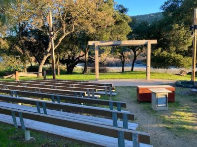
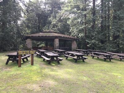
Amphitheater with picnic area with covered BBQ and benches. Perfect for weddings or other events.
Meeting Location
Latitude: 37.011436
Longitude: -121.7078305
The address below is for the Mt. Madonna park entrance.
7850 Pole Line Rd
Watsonville, CA 95076
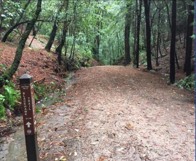
Beautiful Canyon Trail with seasonal creek, bridges, and redwoods.
Meeting Location
Latitude: 37.0056
Longitude: -121.7095
The address below is for the Mt. Madonna park entrance.
7850 Pole Line Rd
Watsonville, CA 95076
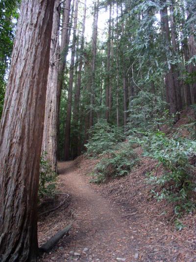
Short hike past two old growth redwoods.
Meeting Location
Latitude: 36.998862694509754
Longitude: -121.70004555999427
The address below is for the Mt. Madonna park entrance.
7850 Pole Line Rd
Watsonville, CA 95076
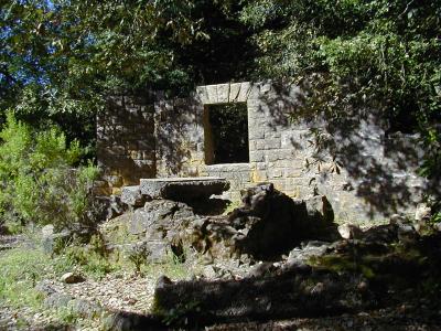
The old stone footprint of the Miller family vacation home and the starting point to our pathway of wildlife hikes.
Meeting Location
Latitude: 37.0120042
Longitude: -121.7046855
The address below is for the Mt. Madonna park entrance.
7850 Pole Line Rd
Watsonville, CA 95076
A reservable group site.
Meeting Location
Latitude: 37.002158
Longitude: -121.707722
The address below is for the Mt. Madonna park entrance.
7850 Pole Line Rd
Watsonville, CA 95076
Day use picnic area. Fees required.
Meeting Location
Latitude: 37.01271725421503
Longitude: -121.70933821627156
The address below is for the Mt. Madonna park entrance.
7850 Pole Line Rd
Watsonville, CA 95076
Meeting Location
Latitude: 37.011441
Longitude: -121.706384
The address below is for the Mt. Madonna park entrance.
7850 Pole Line Rd
Watsonville, CA 95076
Reservable day use group area.
Meeting Location
Latitude: 37.0112634
Longitude: -121.7133443
The address below is for the Mt. Madonna park entrance.
1 Blackhawk Canyon Road
Watsonville, CA 95076
The Sprig Day Use Area provides easily accessible parking to the Sprig, Merry-go-round, Blackhawk, and Ridge Trails.
Meeting Location
Latitude: 37.00395174705567
Longitude: -121.68202879312618
The address below is for the Mt. Madonna park entrance.
