21785 Almaden Rd
San Jose, CA 95120
For UP-TO-DATE trail closure information, call (408) 355-2200, press 3.
Occasional and brief trail closures may be posted at trailheads for the following trails as we undertake the installation of irrigation mains on the downslope edge of Mine Hill Trail and other finishing work related to the calcine remediation project: Wood Rd Trail, Kitty Monahan Trail (formerly Yellow Kid Trail), Castillero Trail, Hidalgo Cemetery Trail, Mine Hill Trail. Your understanding and cooperation during these intermittent closures are greatly appreciated.
*Please help maintain safety on our streets and obey all traffic and speed limit signs in and around the park.
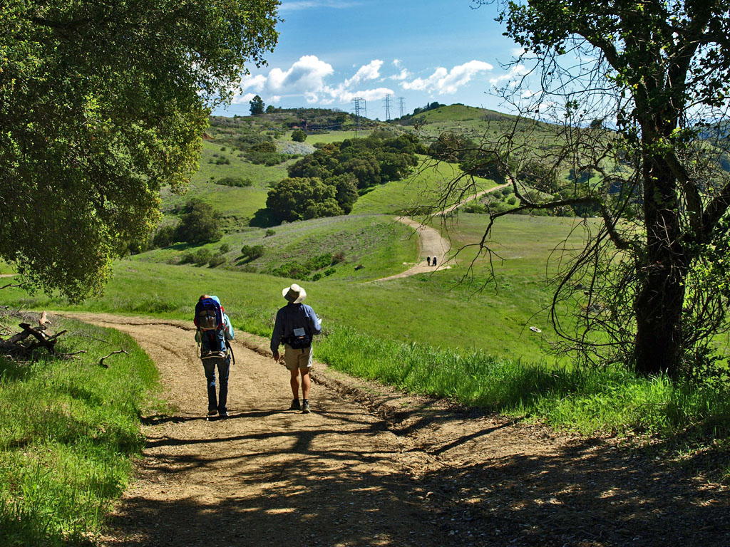
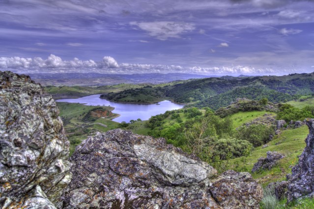
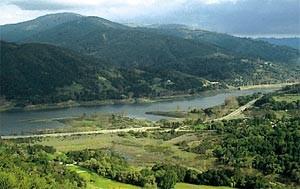
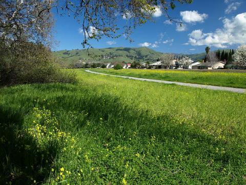
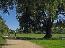
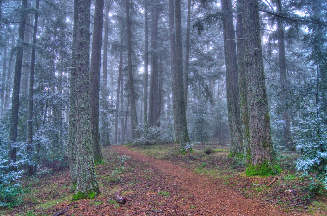
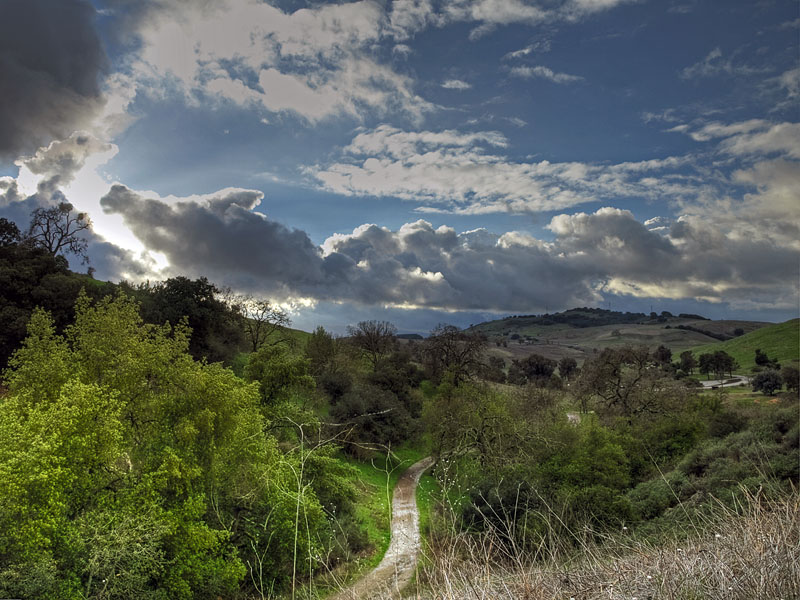
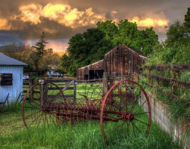
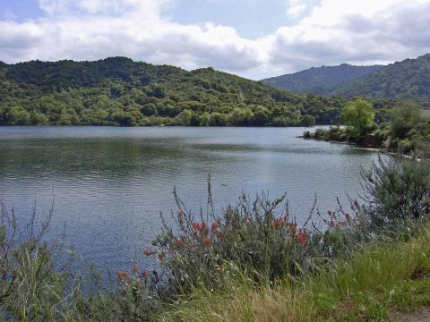
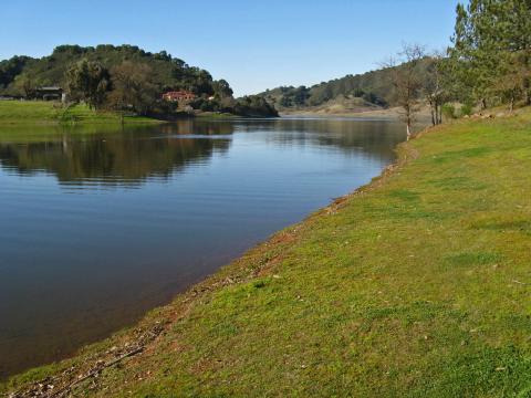
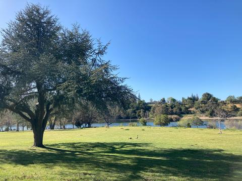
Welcome to Almaden Quicksilver County Park, spectacular in natural diversity and a landmark of California history. The park is the site of over 135 years of mining activities and former home to more than 1,800 miners and their families. The park encompasses 4,163 acres, occupying a majority of Capitancillos Ridge. During early spring, the park offers one of the most spectacular wildflower displays in the region. Remnants of the mining era also offer an exciting look into the mining operations of the latter part of the 19th century.
How to Get There
Almaden Quicksilver County Park is located at:
21785 Almaden Rd San Jose, CA 95120
Park Office: (408) 535-4070
Mining Museum: (408) 918-7770
Almaden Quicksilver County Park is located in south San Jose, in the town of New Almaden. The New Almaden Quicksilver Mining Museum is located at 21350 Almaden Road, San Jose, CA 95120.
The park may be accessed from three areas. The Mockingbird Hill entrance is accessed off Mockingbird Hill Lane. This entrance is accessible to all users, including bicyclists. From Highway 85, take the Almaden Expressway exit south 4.5 miles to Almaden Road. Proceed 0.5 miles on Almaden Road to Mockingbird Hill Lane, turn right and continue 0.4 miles to the parking area.
The Hacienda entrance is located at the south end of New Almaden. This entrance is accessible to all users, including bicyclists. From Almaden Expressway, proceed 3 miles along Almaden Road through the town of New Almaden to the unpaved staging area on the right.
The Wood Road entrance is accessed off Wood Road. From Highway 85 take the Camden Avenue exit south. Turn right on Hicks Road and follow for 6 miles. At the intersection of Wood Road and Hicks Road, turn left into the staging area.
Activities
Hiking, Biking, and Picnicking
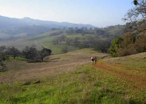
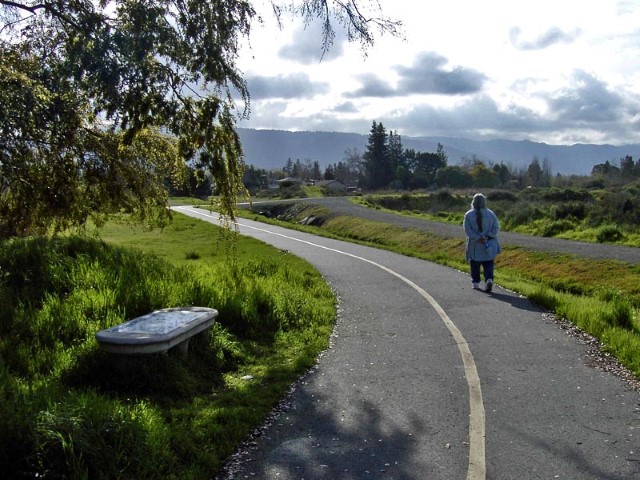
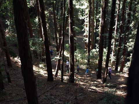
The park includes over 37 miles of hiking trails, including 30 miles of equestrian trails and 16.6 miles of bike trails. All trails in the park are also open to pet owners to walk their dogs on leash.
A number of picnic tables are scattered throughout the park adjacent to the trails and horse water troughs are available in a few locations. No potable water is available within the park except at the Hacienda and Mockingbird Hill entrances.
There are also remnants of mining structures throughout the park. All mines and adits have been sealed. However, the San Cristobal mine may be viewed from behind a locked gate. For your safety, please do not climb on any structures.
New Almaden Quicksilver Mining Museum
The mining museum is open year round and has exhibits about the history of mercury mining in New Almaden and the mining communities who lived here. Open hours vary. Please check out the New Almaden Quicksilver Mining Museum webpage or call 408-918-7770 for the most up to date information.
Public Programs, School Programs, and Events
Custom guided nature walks, history walks, and tours of the mining museum are available upon request. Please visit our Custom Programs & Tours webpage for more information and to submit a request. For information on school field trip opportunities, visit the Education webpage or email [email protected].
Check our Events Calendar for public programs and events at Almaden Quicksilver and other Santa Clara County Parks.
Fishing
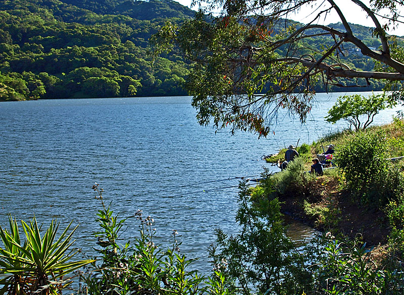
CATCH AND RELEASE... PLEASE DON'T EAT THE FISH
Mercury has been found to accumulate in Guadalupe and Almaden Reservoirs at levels that make the fish from those reservoirs unsafe to eat. Almaden Quicksilver County Park was once the site of extensive quicksilver (mercury) mining. Sediments that contain mercury have been deposited in some of the local reservoirs and streams. Over time, the mercury in the sediment may have been converted to methyl mercury by naturally occurring bacteria. Methyl mercury is absorbed by aquatic plants and fish, and subsequently by humans who may eat the contaminated fish. If you have any questions regarding mercury and its effects, please contact the County's Environmental Health Services at (408) 918-3400.
If you have any questions regarding the above information, please email the Park's Communication Officer at [email protected].
Online Historical Collections
Be sure to check our online historical collections to see photos, documents, and artifacts related to Almaden Quicksilver County Park. You can also view artifacts from Martial Cottle County Park or Joseph D. Grant County Park and can request images from us.
Hours and Fees
The park is open year-round from 8:00 a.m. until sunset. Park trails are subject to closure due to poor conditions, typically after heavy rains. No fees are required at any entrances.
Accessibility
In compliance with the requirements of Title II of the Americans with Disabilities Act of 1990 (‘ADA'), the Santa Clara County Parks and Recreation Department will not discriminate against qualified individuals with disabilities on the basis of disability in its programs, services, or activities. The Department will make reasonable modifications to policies and programs to ensure that people with disability have an equal opportunity to enjoy our programs, services, facilities, and activities. If you need assistance with an ADA request, please contact our ADA Coordinator.
Additional Documents
1195 Hope St
San Jose, CA 95002
IMPORTANT VISITOR ALERT: Please refrain from walking off the trails, especially near the salt pond. The area surrounding the pond is part of the Don Edwards San Francisco Bay National Wildlife Refuge. To protect migratory birds, endangered species, and other wildlife, walking to the pond's edge, as well as bringing dogs and drones, is strictly prohibited. Thank you for your curiosity and cooperation in protecting Alviso’s wetlands for wildlife and future generations.
Trail Closure: Mallard Slough Trail is closed due to construction as well as sections of Alviso Slough Trail at Don Edwards San Francisco Bay National Wildlife Refuge. The South San Francisco Bay Shoreline Project (Phase I) between the Alviso Slough/Guadalupe River and Coyote Creek is underway and construction is scheduled to be completed by summer 2025. For more information, see the South San Francisco Bay Shoreline Project fact sheet.
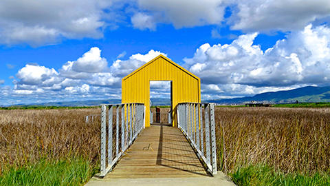
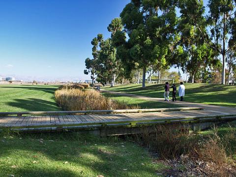
Welcome to Alviso Marina County Park, gateway to the Don Edwards San Francisco Bay National Wildlife Refuge. This 20.6 acre bayside park, located along Alviso slough and adjacent to the salt ponds and marshes of Don Edwards San Francisco Bay National Wildlife Refuge. Though small in size, the Park offers a great deal of activities within its boundaries and on into the Wildlife Refuge. The pathways and boardwalks of the County Park and trails around the ponds in the adjacent Wildlife Refuge, and the regional trails which include the San Francisco Bay Trail and San Francisco Bay Area Water Trail, offer fantastic views of the mountains surrounding the bay, and of the wildlife that call these ponds home.
How to Get There
Alviso Marina County Park is located at:
1195 Hope St San Jose, CA 95002
Park Office: (408) 262-6980
Directions
From Highway 880:
Take Highway 237 (Alviso-Milpitas Road) west to North First Street exit. Turn right on North First Street (which becomes North Taylor); turn right on Gold Street, left on Elizabeth Street and right on Hope Street.
From Highway 101:
Take Highway 237 (Mt. View-Alviso Road) east to Great America Parkway exit. Turn left onto Great America Parkway, turn right on Gold Street connector, left on Gold Street, left on Elizabeth Street and right on Hope Street.
Activities
Alviso Boat Tour
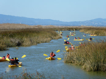
Join park staff on an interpretive boat ride through Alviso Slough to learn how the South San Francisco Bay’s shoreline has changed over time. Click HERE to register for a spot on the FREE Alviso Boat Tour! if you are an educator for grades 6+ and would like to bring your class out on the slough, please check out the EDUCATION PROGRAMS page HERE and scroll down to Exploring Our Changing Bay.
(c) Mylene Stolpe, Charismatic Photography
Self-Guided Opportunities
Hiking, biking and bird watching are favorite activities in both the park and the refuge, while picnicking and strolling along the manicured pathways can be enjoyed within the County Park. Dogs are allowed in the County Park's pathways and picnic areas, but are not allowed on the trails, levees and boardwalks. While bikes are allowed on all pathways and trails in the park, please walk your bikes on the boardwalks.
Boat Launch
The boat launch ramp provides one of the few clear routes in the San Jose area through the salt marshes of Alviso slough out to the open waters of the San Francisco Bay. The boat launch ramp provides access for both motorized and non-motorized boats and includes concrete launch ramps and two floating docks. Alviso Marina County Park is a Designated Site in the San Francisco Bay Area Water Trail Network. Please see the San Francisco Bay Trail or San Francisco Bay Area Water Trail websites for more information about these regional trails. Navigational charts can be obtained through NOAA or a local retailer (Ref. No. 18AHA18651). When using the waters of the bay, please respect the sensitive nature of this unique ecosystem.
Don Edwards San Francisco National Wildlife Refuge
For more information about the Don Edwards San Francisco Bay National Wildlife Refuge, visit their website HERE. For inquiries about the Environmental Education Center, field trips, trails, and interpretive programs, call (408) 262-5513.
Hours & Fees
The park is open year-round from 8 a.m. to sunset. There are no fees collected at this time for vehicle entry or launching.
Santa Clara County's Alviso Marina is the primary access in Santa Clara County for vessel owners to launch into San Francisco Bay. Fishermen and hunters who want access to the launch ramp after hours will need to purchase an annual Gate Key.
To purchase a Gate Key, you must complete the Alviso Marina County Park Gate Key Form, (see below) read, sign and submit with current payment to the Santa Clara County Parks Administration Office, Attention: ALVISO, 298 Garden Hill Drive, Los Gatos, CA 95032. Annual fee is $75.00.
Prices are subject to change.
Accessibility
In compliance with the requirements of Title II of the Americans with Disabilities Act of 1990 ('ADA'), the Santa Clara County Parks and Recreation Department will not discriminate against qualified individuals with disabilities on the basis of disability in its programs, services, or activities. The Department will make reasonable modifications to policies and programs to ensure that people with disability have an equal opportunity to enjoy our programs, services, facilities, and activities. If you need assistance with an ADA request, please contact our ADA Coordinator.
Alviso Marina County Park is officially designated as part of the San Francisco Bay Area Water Trail and has ADA compliant parking, restrooms, picnic areas, and trails with access to the beautiful salt marshes on the southern portion of the San Francisco Bay.
For more information about the features of Alviso Marina County Park, including detail of all ADA amenities, see the Alviso County Park Marina Site Plan prepared in cooperation with the Coastal Conservancy, Association of Bay Area Governments and the San Francisco Bay Area Water Trail, and our Alviso County Park Map.
Attachments
19245 Malaguerra Ave
Morgan Hill, CA 95037
Starting Oct. 1, 2020, the following recreation areas will be closed:
- Toyon Group Picnic and Parking Areas; Serpentine Trail; Dam Crest Woodchoppers Flat
- Anderson Lake Park's boating and fishing, boat and vehicle parking areas, and boat ramp.
- Coyote Road from the toe of the dam to the boat and vehicle parking areas; and Lakeview Trail is closed from the Anderson Launch Ramp parking lot trailhead to the westernmost junction with the Rancho Laguna Seca Trail.
-Fishing will be closed for the entire reservoir shoreline The Live Oak Picnic Area will remain open to the public and can be accessed from Cochrane Road.
For project updates and to learn more about the Anderson Dam Seismic Retrofit Project: Valley Water Anderson Dam Seismic Retrofit
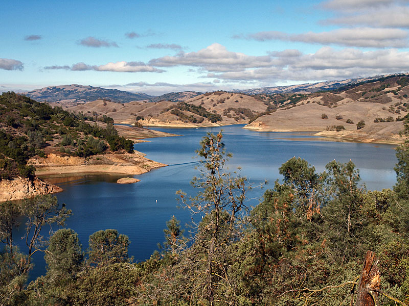
Welcome to Anderson Lake County Park, Santa Clara County's largest reservoir. The 4,275 acre Anderson Park also features the Coyote Creek Parkway multiple use trails, the Jackson Ranch historic park site, the Moses L. Rosendin Park, and the Burnett Park area. This unique combination of recreational resources make Anderson Lake County Park a magnet for power boat enthusiasts, bicyclists, equestrians, picnickers, and nature lovers. Enjoy your visit today, and return often to
experience the many recreational opportunities of Anderson Lake County Park.
About Anderson Lake
In January 2009, the water district hired a consultant to evaluate the seismic stability of Anderson Dam. Preliminary findings of the study indicate that part of the dam would be seismically unstable during a very large, 7.25-magnitude earthquake occurring on the Calaveras Fault approximately two kilometers of the dam. Other large earthquakes occurring close to the dam could also cause considerable damage to it. View here for more information.
How to Get There
Anderson Lake County Park is located at:
19245 Malaguerra Ave Morgan Hill, CA 95037
Park Office: (408) 918-7980
Anderson Lake and the picnic areas along the Coyote Creek are located on Cochrane Road in Morgan Hill, east of Highway 101. To reach the Woodchopper's picnic area or the Jackson Ranch, follow Dunne Avenue east from Highway 101. The Coyote Creek Parkway multiple use trails can be reached by following Cochrane Road.
Anderson Lake Visitors Center access to Coyote Creek Parkway is at 19245 Malaguerra Avenue. Access to the reservoir is 18295 Coyote Road.
Activities
Anderson Reservoir, a seven-mile long, 953 surface acre lake, is under construction until 2030.
First-come, first-served family picnic areas are available year round along Coyote Creek. One group picnic area is available by reservation.
Fishing is not permitted on Anderson Lake while under construction. Fishing is also allowed in Coyote Creek during fishing season (April - November), special fishing regulations apply.
Hikers, runners, bicyclists, equestrians, and skaters can enjoy the multiple use paved trail which follows Coyote Creek north for fifteen miles to Hellyer County Park. This asphalt path is relatively flat and meanders along the creek underneath Oak, Cottonwood, and Sycamore trees. An equestrian staging area with trailer parking, rest areas are provided, but water is not available.
Events
Each year, Santa Clara County Parks celebrates the role of Coyote Creek in the watershed and wildlife habitat of Santa Clara County with an event called Coyote Creek Habitat Day. The event takes place at the Coyote Creek Visitor Center at Anderson Lake County Park. You can find out more about Coyote Creek Habitat Day here.
Field Trips
Guided educational programs are available by reservation for groups of up to 35 students. Programs are offered weekday mornings during the school year and allow students to explore a riparian habitat and learn about how animals stay safe and survive in their environment.
The school program meets Next Generation Science Standards for students in grades 1 and 2.
For additional information about our educational programs and teaching resources, visit our Education Programs page or email [email protected].
Groups of 10 or more who wish to visit the park on weekday mornings are advised to call (408) 846-5632 in advance to find out if their group's activities may be impacted by previously scheduled event in the park.
Hours and Fees
The park is open year-round from 8 a.m. until sunset. Vehicle entry fees are collected at Anderson year-round. Fees are also required for group picnic reservations.
Access fees information here: Park Fees
In compliance with the requirements of Title II of the Americans with Disabilities Act of 1990 ('ADA'),the Santa Clara County Parks and Recreation Department will not discriminate against qualified individuals with disabilities on the basis of disability in its programs, services, or activities. The Department will make reasonable modifications to policies and programs to ensure that people with disability have an equal opportunity to enjoy our programs, services, facilities, and activities. If you need assistance with an ADA request, please contact our ADA Coordinator.
Attachments
23205 McKean Rd
San Jose, CA 95120
Welcome to Calero County Park, one of Santa Clara County's most diverse regional park and recreation areas. Once part of the Pueblo lands of San Jose, and Rancho San Vincente land grant, this approximate 4,471 acre park is nestled in the eastern foothills of the Santa Cruz Mountains. Two distinct areas define this park: the reservoir, which offers a host of water-oriented recreational activities, and the adjoining "back country" which reveals to the visitor California Oak woodland, chaparral, riparian plant communities and associated wildlife habitats. During the months of March, April and May the "back country" offers a spectacular display of wildflowers. In addition, the park offers breathtaking views of southern Santa Clara County and the surrounding Santa Cruz Mountain Range. Enjoy your visit today, and return again to experience the diversity of Calero County Park.
How to Get There
Calero County Park is located at:
23205 McKean Rd San Jose, CA 95120
Park Office: (408) 535-4070
The boat launch area and the park entrance/trail head are located off McKean Road. Traveling to the boat launch area from Central San Jose, take Almaden Expressway south to Harry Road. Turn right onto Harry Road; then left onto McKean Road. The reservoir is on the right; about three miles south of Harry Road. Traveling to the park on southbound Highway 101, exit Bailey Ave (Exit 373) and turn right. Head west on Bailey Ave until you reach McKean Rd. Turn right and continue about 0.5 miles and the entrance to the reservoir will be on your left. Traveling on northbound Highway 101, exit Bailey Ave (Exit 373) and turn left onto Bailey Ave heading west. Continue on Bailey Ave until you reach McKean Rd and make a right. In 0.5 miles is the entrance to the reservoir.
To reach the trailhead staging area and access to the 18.9 miles of trails, follow the directions above but at Bailey Ave and McKean Rd turn left onto McKean Rd (southbound) and continue 0.5 miles to the park entrance on your right.
Activities
The reservoir is open year-round to both power and non-power vessels. Power boating, sailing, fishing, water-skiing and jet-skiing are all activities for which Calero Reservoir is ideally suited. Two sites near the water's edge include picnic tables and barbecues, and are available on a first-come, first-served basis. A reservable group picnic area is also available. Group picnic,, boating reservations, and boat inspections can be made online at Go Outside and Play or call (408) 355-2201.
The back country offers 18.9 miles of trails available to hikers and equestrians. At the trailhead is a large staging area , which can accommodate vehicle and equestrian parking and is adjacent to the park office. Bicyclists can now enjoy the 0.5-mile segment of the Serpentine Loop Trail that connects to Longwall Canyon Trail in the Open Space Authority’s Cañada del Oro Open Space Preserve. All users will now be able to use trails that connect these two parks.
Dogs on leash will be allowed on Bald Peaks Trail and all trails north of Bald Peaks Trail.
First-come, first-served picnic sites with barbeques are available. This area may be reserved for organized events and gatherings. Arrangements can be made with park staff for a wide range of interpretive programs and outdoor projects.
CATCH AND RELEASE... PLEASE DON'T EAT THE FISH
Mercury has been found to accumulate in Calero Reservoir at levels that make the fish from Calero Reservoir unsafe to eat.
The nearby Almaden Valley area of Santa Clara County was once the site of quicksilver (mercury) mining. Sediments containing mercury have been deposited in some of the local reservoirs. Over time, the mercury in the sediment may have been converted to methyl mercury by naturally occurring bacteria. Methyl mercury is absorbed by aquatic plants and fish, and subsequently by humans who may eat the contaminated fish. If you have any questions regarding mercury and its effects, please contact the County's Environmental Health Services, (408) 918-3400
Hours and Fees
The park is open year-round from 8 a.m. until sunset. The reservoir use hours are 8 a.m. until 30 minutes before sunset. Reservoir and vehicle use fees are collected daily. Launch and entry fees are posted at the kiosk. There is no fee for parking at the trailhead staging area.
Access Fees Information Here: Park Fees
Accessibility
In compliance with the requirements of Title II of the Americans with Disabilities Act of 1990 ('ADA'),the Santa Clara County Parks and Recreation Department will not discriminate against qualified individuals with disabilities on the basis of disability in its programs, services, or activities. The Department will make reasonable modifications to policies and programs to ensure that people with disability have an equal opportunity to enjoy our programs, services, facilities, and activities. If you need assistance with an ADA request, please contact our ADA Coordinator.
Attachments
17655 Oak Glen Ave
Morgan Hill, CA 95037
Welcome to Chesbro Reservoir County Park. This beautiful and scenic 232 acre park and reservoir is located in the foothills of the Santa Cruz Mountains west of Morgan Hill. The reservoir's rural setting is located just minutes from Morgan Hill and Gilroy.
About Chesbro Reservoir
The Chesbro Reservoir was formed from the damming of Llagas Creek. The area was frequented by the Mutsun Ohlone Indians for thousands of years before the arrival of the Europeans. Today's reservoir was once part of two Mexican land grants from Mexican Governor Figueroa. The 8,927 acre Rancho Ojo de Agua de la Coche ("pig spring") was granted to Hernandez in 1835 and the 22,283 acre Rancho San Francisco de las Llagas (St. Francis of the wounds) was granted to C. Castro in 1834. The ranchos were eventually acquired by Martin Murphy, an early pioneer of Santa Clara County. By 1860, the lands had been patented to his grandson. The construction of Chesbro Dam in 1955 was part of a countywide effort by water officials to ensure adequate water supplies for the valley's growing population. The new reservoir was named for Elmer J. Chesbro, a local doctor who was president of the South Santa Clara Valley Water Conservation District at the time of its construction. The reservoir which captures water from the Llagas Creek watershed, is used to recharge supplies in underground aquifers to provide water to be pumped from wells for residential, agricultural, and industrial uses.
How to Get There
Chesbro Reservoir County Park is located at:
17655 Oak Glen Ave Morgan Hill, CA 95037
Park Office: (408) 779-9232
Chesbro Reservoir County Park is located in the foothills east of the Santa Cruz Mountains and west of the City of Morgan Hill. The reservoir and park are accessible from U.S. Highway 101 or 85. From Santa Clara Valley, take the Bernal Road exit from U.S. 101 or 85. From the Bernal Road exit proceed west about 0.2 miles to Monterey Highway south. Take Monterey Highway south 3.4 miles to Bailey Road. Turn right and follow Bailey Road 2.8 miles west over a ridge to McKean Road. Turn left on to McKean/Uvas Road (McKean Road becomes Uvas Road 2.2 miles south of Bailey Road) and travel south 4.5 miles to Oak Glen Avenue. Turn left on to Oak Glen Avenue and travel adjacent to Chesbro Reservoir 2.3 miles to the parking lot and boat launch area (near the dam).
From U.S. 101 between Morgan Hill and Gilroy, take the Tennant Avenue exit west one mile to Monterey Highway. At Monterey Highway, Tennant Avenue becomes Edmundson Avenue. Proceed 1.8 miles west on Edmundson and turn right on to Oak Glen Avenue. Travel 1.6 miles on Oak Glen Avenue to Llagas Avenue and turn left to continue on Oak Glen Avenue. Follow Oak Glen Avenue another 0.6 miles to the parking lot and boat launch area.
Activities
Activities at the park center around the reservoir. There are no designated trails within the park at this time. To find out more information, call (408)779-9232.
Hours and Fees
The park is open year-round from 8:00 a.m. until sunset.
Accessibility
In compliance with the requirements of Title II of the Americans with Disabilities Act of 1990 ('ADA'), the Santa Clara County Parks and Recreation Department will not discriminate against qualified individuals with disabilities on the basis of disability in its programs, services, or activities. The Department will make reasonable modifications to policies and programs to ensure that people with disability have an equal opportunity to enjoy our programs, services, facilities, and activities. If you need assistance with an ADA request, please contact our ADA Coordinator.
Additional Documents
View here for NEW Boating
Inspection Procedures
Chesbro and Uvas Reservoirs are
closed to all boating.
10001 Watsonville Rd
Gilroy, CA 95020
Welcome to Chitactac-Adams Heritage County Park. This beautiful and culturally significant 4.5 acre park site is located just minutes from the cities of Gilroy and Morgan Hill. The park features the beautiful Uvas Creek and a wealth of cultural artifacts including bedrock mortars and petroglyphs left by the native people who occupied the area for thousands of years. The park includes a self-guided interpretive walk and an interpretive shelter focusing on tribal culture and the Adams schoolhouse which was located on this property from the 1850s until 1956.
How to Get There
Chitactac-Adams Heritage County Park is located at:
10001 Watsonville Rd Gilroy, CA 95020
Park Office: (408) 842-2341
From Highway 101, take the Tennant Avenue exit in Morgan Hill and proceed west towards Monterey Highway. Turn left (south) on Monterey Highway and travel approximately 0.5 mile south to Watsonville Road. Take Watsonville Road west 5.5 miles to the park site which is located on the west side of the road across from the intersection of Watsonville Road and Burchell Road.
Activities
Chitactac-Adams Heritage County Park offers a unique view into the Native American culture of Santa Clara County. A self-guided interpretive walk around the site highlights the Adams School, Village life, petroglyphs (rock art), use of bedrock mortars for food processing, and the natural and cultural history of Uvas Creek.
The site includes chemical toilets, potable water and a limited number of picnic tables. No barbecue facilities are available.
Visit our Education Programs page or email [email protected] for more information on school programs.
Check the Events Calendar for public programs and events at Chitactac-Adams and other Santa Clara County Parks.
Field Trips:
Guided educational programs are available by reservation for groups of up to 35 students. Programs are offered weekday mornings during the school year and give students a glimpse of what life was like for the Native American people that once inhabited this site. For additional information about our educational programs and teaching resources, visit our Education page or email [email protected].
Groups of 10 or more who wish to visit the park on weekday mornings are advised to call (408) 846-5632 in advance to find out if their group's activities may be impacted by previously scheduled event in the park.
Hours and Fees
The park is open daily year-round from 8 a.m. - sunset. There are no vehicle entry fees.
The self-guided tour and exhibit shelter are accessible all times the park is open.
Dogs are not permitted.
Accessibility
In compliance with the requirements of Title II of the Americans with Disabilities Act of 1990 ('ADA'), the Santa Clara County Parks and Recreation Department will not discriminate against qualified individuals with disabilities on the basis of disability in its programs, services, or activities. The Department will make reasonable modifications to policies and programs to ensure that people with disability have an equal opportunity to enjoy our programs, services, facilities, and activities. If you need assistance with an ADA request, please contact our ADA Coordinator.
Attachments:
Longitude: -121.7362445
Latitude: 37.21813777
San Jose, CA 95032
Welcome to Coyote Creek Parkway. This scenic parkway meanders along Coyote Creek for 15 miles. The north portion features a paved multi-use trail popular with bicyclists, rollerbladers, and hikers. South of Metcalf Road, an equestrian trail parallels the paved trail. Public transit is available to Coyote Creek Parkway.
For more information, see the Hellyer County Park page or the Anderson Lake County Park page.
Hours and Fees
The park is open year-round from 8 a.m. until sunset. There are no parking fees collected.
RC Airfield
Vehicle access to the RC airfield has been restored for members. RC flyers need to have a AMA and SCCMAS membership.
Accessibility
In compliance with the requirements of Title II of the Americans with Disabilities Act of 1990 ('ADA'),the Santa Clara County Parks and Recreation Department will not discriminate against qualified individuals with disabilities on the basis of disability in its programs, services, or activities. The Department will make reasonable modifications to policies and programs to ensure that people with disability have an equal opportunity to enjoy our programs, services, facilities, and activities. If you need assistance with an ADA request, please contact our ADA Coordinator.
Attachments
10840 Coyote Lake Road
Gilroy, CA 95020
Recreational boating and water activities (power and non-power) opened for the season on April 13, 2024. Hours are 8:00 am to 30 minutes prior to sunset.
Welcome to Coyote Lake Harvey Bear Ranch County Park, this 6,695 acre regional recreation area, nestled in the hills east of Gilroy, CA, features a 449 acre lake for fishing and boating. Coyote Lake has a “world-class” population of black bass, as well as bluegill, black crappie, and Eurasian carp. Both powered and non-powered vessels can ply the waters of the lake.
About Coyote Lake Harvey Bear Ranch
Coyote Bear provides habitats for many species of birds, reptiles, amphibians, insects and mammals. The park is home to rare western pond turtle, California tiger salamander and Bay checkerspot butterfly. Two-Hundred-Nineteen species of birds have been seen, including our “National Bird” the bald eagle. During your visit you can also be sure to see black-tailed deer, and turkeys. Even mountain lions have been seen by visitors in the park’s hinterlands.
The park provides campsites for 73 RV and tent campers. All sites have a table, grill/fire pit, and food storage locker. RV sites have electricity, water hook-ups; and a dump station is located nearby. Hot showers are available to all campers.
Hikers, horseback riders and off-road bicyclists can explore over 33 miles of trails that wind through cool oak forests and along breezy ridgelines with wonderful views. At the Bear Ranch Trailhead in San Martin, there is a 2-mile paved loop that is popular with joggers, dog-walkers, and people just wanting to get outside to exercise and get some fresh air.
Coyote Lake Harvey Bear Ranch County Park is a great place visit, close to home, yet a world away!
How to Get There
Coyote Lake Harvey Bear Ranch County Park is located at:
10840 Coyote Reservoir Rd Gilroy, CA 95020
Park Office: (408) 842-7800
There are three entrances into Coyote Lake Harvey Bear Ranch County Park:
Bear Ranch - from U.S. Highway 101 in San Martin, take the San Martin Ave exit. Proceed east on San Martin Ave for 2 miles. The entrance to the park is on the left, 0.25 mile east of Foothill Avenue.
Mendoza Ranch - From U.S. Highway 101 in Gilroy, take the Leavesley Road exit. Proceed east on Leavesley Road 2 miles to New Avenue. Proceed north on New Avenue 0.5 miles to Roop Road. Proceed east on Roop Road 3 miles into the foothills. Turn left into the park.
Coyote Lake - From U.S. Highway 101 in Gilroy, take the Leavesley Road exit. Proceed east on Leavesley Road 2 miles to New Avenue. Proceed north on New Avenue 0.5 miles to Roop Road. Proceed 3.5 miles east on Roop Road into the foothills past the Mendoza Ranch entrance. Turn left into the park and proceed 1 mile north to the entrance station and visitor center.
Activities
Coyote Lake Harvey Bear Ranch County Park offers a myriad of outdoor activities.
Start your visit at the park visitor center. There you can see exhibits on local wildlife, including live reptiles, amphibians and fish that are native to the park. Here you can also pay park fees, purchase annual park passes, check-in to your campsite, purchase firewood, and pick-up park information.
Rangers provide interpretative programs year-round. Between Memorial Day weekend and the end of September, Rangers and Docents conduct campfire programs on Saturday evening. Finally, Ranger-lead programs take place monthly throughout the park.
Three-mile long Coyote Lake provides opportunities for power boating, jet-skiing, waterskiing, sailing, canoeing/kayaking and fishing. Swimming is not allowed by order of the Santa Clara Valley Water District. The boat launch ramp is located two miles north of the visitor center. It has two docks, a 3-lane concrete ramp, paved parking and a restroom. For fisherman, the lake contains bluegill, black crappie, channel catfish, carp and black bass. The lake is closed to boating of all kind between mid-October to mid-April. Call (408) 355-2201 to make a boating and boat inspection reservation or go online at Go Outside and Play.
Family picnic sites are located at numerous locations along the west shoreline. BBQ picnic facilities are located south of the Anglers Cove picnic area.
The Lakeview Campground is located 0.5 miles north of the visitor center. It provides campers with 73 reservable sites. 18 sites have water and electric hook-ups for RV's. Each site has a paved slip, picnic table, BBQ/campfire pit and food locker. There is a RV dump station in the park. The campground also has three restrooms, a shower building (no charge), and numerous drinking water taps. Campground check-out time is 1:00 p.m.. Campground check-in time is 3:00 p.m. View more information on camping. Call (408) 355-2201 to make a camping reservation or go online at Go Outside and Play.
The Bear and Mendoza Ranch sections of the park have 35 miles of hiking, biking and equestrian trails that wind through oak studded canyons; and on top of grassy ridgelines, providing spectacular views of southern Santa Clara Valley. Trailheads can be found in all three sections of the park.
Park Trails Hotline: For general open/close information, please call (408) 355-2200 and press 7 for a listing of parks. For trail closure information call (408) 355-2200 and select option 3.
Hours and Fees
The park is open year-round for general day use from 8 a.m. to sunset. The lake closes to boating each day 30 minutes before sunset. The park is open for "shoreline fishing only" 24-hours a day.
Vehicle entry fees are collected year-round. Fees are required for camping. Fees are also required for boating and boating inspections. Fees are posted at the entrance kiosk.
Access fees information here: Park Fees
Accessibility
In compliance with the requirements of Title II of the Americans with Disabilities Act of 1990 ('ADA'),the Santa Clara County Parks and Recreation Department will not discriminate against qualified individuals with disabilities on the basis of disability in its programs, services, or activities. The Department will make reasonable modifications to policies and programs to ensure that people with disability have an equal opportunity to enjoy our programs, services, facilities, and activities. If you need assistance with an ADA request, please contact our ADA Coordinator.
Attachments
3100 Calaveras Rd
Milpitas, CA 95035
Trail Closures:
-The Azores Trail and the Los Coches Ridge Trail (between Junctions #53 and #68) are closed to equestrians due to wet conditions.
-The hang glider road (Monument Peak Road) is CLOSED. No vehicular traffic permitted. All others should exercise extreme caution if using the road and plan alternate trail routes.
-The 1750’, 600’ hang glider launch points are CLOSED to vehicular traffic.
-The 300’ hang glider launch point is OPEN.
- A section of the Spring Valley Trail is closed indefinitely due to a slide.
The youth campground is currently OPEN.
Welcome to Ed R. Levin County Park, one of Santa Clara County's most unique regional park and recreation areas. This 1,558 acre park combines the traditional features of an urban park such as picnicking, fishing and play areas, with the complex trail system of many regional wilderness parks. Ed R. Levin's expansive lawn areas make it an ideal spot for family outings, while the rolling grasslands and Oak woodlands are available to visitors looking for a back-to-nature experience. The park's Monument Peak provides a spectacular view of the valley floor and the San Francisco Bay. Enjoy your visit, and return often to enjoy the many unique aspects of Ed R. Levin County Park.
Also featured at the park is an expansive off-leash dog park for large and small dogs alike! Owned and operated by the City of Milpitas this dog park is one of the most popular features in Ed R. Levin County Park. Dogs are also allowed on-leash in parking lots, picnic areas, and all trails north of Calaveras Road.
How to Get There
Ed R. Levin County Park is located at:
3100 Calaveras Rd Milpitas, CA 95035
Park Office: (408) 262-6980
Traveling on either Interstate 680 or 880, take the Calaveras Road exit in Milpitas. Drive east towards the foothills along Calaveras Road. Calaveras Road passes through the southern portion of Ed R. Levin Park. There are two main use areas in the park. The Sandy Wool Lake area is located north of Calaveras Road and the Spring Valley Pond area is located south of Calaveras Road. To reach the Sandy Wool Lake area, take a left turn off Calaveras Road onto Downing Road. Travel north along Downing Road to reach Sandy Wool Lake, the hang gliding area and the main trail use areas. To reach the Spring Valley Pond area, continue along Calaveras Road, past Downing Road and turn right into the park area to reach the Ranger station, Visitor Center and Spring Valley Pond. Spring Valley Golf Course parking and Club House is located across Calaveras Road from the Visitor Center.
Activities
Hiking, horseback riding, picnicking and hang gliding are popular activities at Ed R. Levin Park. Visitors may enjoy the playground, fly kites and play frisbee on one of the three lawn areas. The park is also home to the Wings of Rogallo hang gliding club. It is a unique experience to watch these beautiful hang gliders and paragliders soar in the skies above the park.
Fishing is another favorite activity at Ed R. Levin Park. Sandy Wool Lake is stocked from November through May. Swimming is prohibited.
Hikers, equestrians and cyclists may enjoy sections of the park's 20.6 mile trail system. As part of the Bay Area Ridge Trail alignment, sections of the Agua Caliente Trail and the Calera Creek Trail are open to bicyclists. Maps of the entire Bay Area Ridge Trail System may be obtained from the Bay Area Ridge Trail Council. Some of the East Bay Regional Park District's trails also connect to Ed R.Levin Park.
The southern portion of the park, known as the Spring Valley Area, is named for the many springs that flow freely in this area. The large pond is a favorite kids-only fishing hole for children ages 5 through 12 years. The 18-hole Spring Valley Golf Course is also located in this area.
The Laguna Cemetery is also located on the Spring Valley Area. This pioneer cemetery was used from 1863 to 1912. Destroyed by vandals and neglected for years, it has recently been renovated. Stop by the cemetery gates and enjoy the fascinating memorial which provides a glimpse into the lives of the people buried there.
Hours and Fees
The park is open year-round from 8 a.m. until sunset. Vehicle entry fees are collected year-round. Entry fees are posted at the kiosk.
Access fees information here: Park Fees
Accessibility
In compliance with the requirements of Title II of the Americans with Disabilities Act of 1990 ('ADA'),the Santa Clara County Parks and Recreation Department will not discriminate against qualified individuals with disabilities on the basis of disability in its programs, services, or activities. The Department will make reasonable modifications to policies and programs to ensure that people with disability have an equal opportunity to enjoy our programs, services, facilities, and activities. If you need assistance with an ADA request, please contact our ADA Coordinator.
Attachment
9580 Malech Rd
San Jose, CA 95138
Waiver forms are required for all participants. View here to complete the waiver form required upon entry to the park.
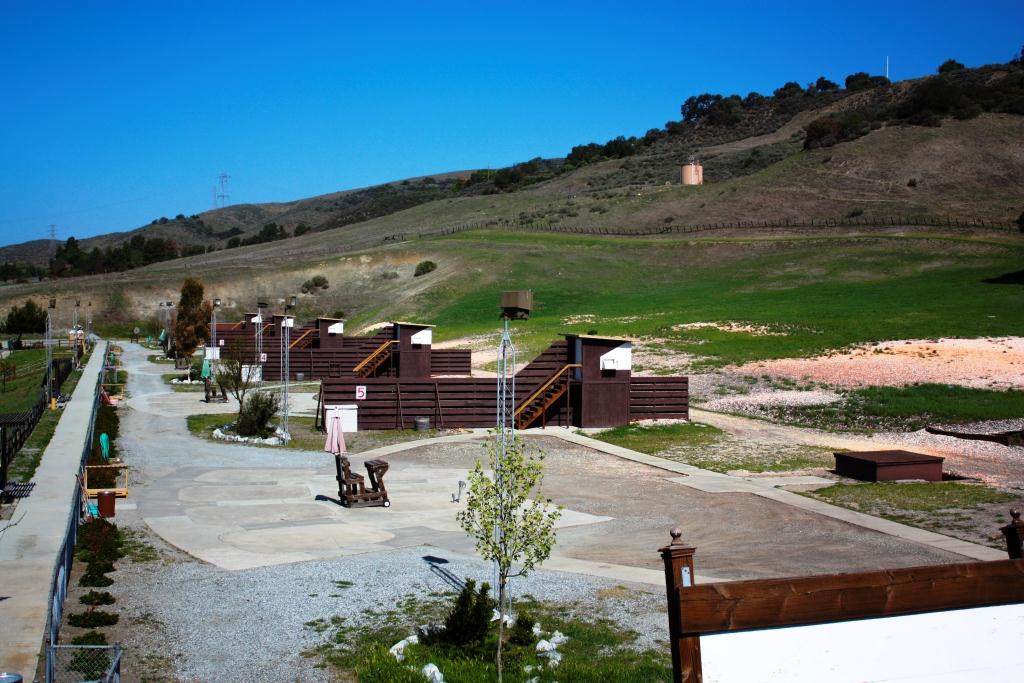
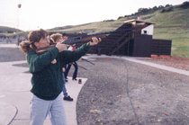
Welcome to Field Sports Park, the County's only publicly owned firing range. This park provides opportunities for rifle and pistol, as well as trap and skeet shooting. League activity and special events take place year-round. Located in south San Jose, Field Sports Park is staffed and supervised by qualified Range Masters at all times.
Range is open on a first come first served basis, no reservations are needed.
How to Get There
Field Sports is located at:
9580 Malech Rd San Jose, CA 95013
Trap and Skeet Range Office: (408) 463-0769
Rifle and Pistol Range Office: (408) 463-0652
Hours
| Day | Trap and Skeet Range | Rifle Pistol Range |
|---|---|---|
| Monday | 4-8pm | 8-4pm |
| Tuesday | 4-8pm | Closed |
| Wednesday | 4-8pm | Closed |
| Thursday | Closed | 8-4pm |
| Friday | Closed | 8-4pm |
| Saturday | 10-4pm | 8-4pm |
| Sunday | 10-4pm | 8-4pm |
200 Yard Range Hours
Open on the fourth weekend of every month (weather permitting)
Operating hours are 9:00 a.m. - 3:00 p.m.
Park Features
- 5 trap fields
- 5 skeet fields
- 22 covered pistol or rimfire positions at 7, 15, and 25 yards
- 26 rifle positions at 50 and 100 yards that are partly covered
- 16 covered positions at 200 yard range*
- Multi-Purpose Range*
*The 200 yard and multi-purpose range are available for reservation with a valid permit. For information contact the Permits and Reservations office at (408) 355-2201 Monday through Friday 8:30am to 12:00pm and 1:00pm to 4:00pm or by email at [email protected].
Range Use Fees
| Trap/Skeet | Rifle/Pistol |
|---|---|
| $9 per round/game | $15 per adults with NO time limit |
| $7 per round/game for league | $10 for seniors 60+/disabled/Veterans/Peace Officers with NO time limit |
| $18 per round(50 targets) Double Trap | $6 for juniors (less than 13 years of age) |
| Doubles Trap and Wobble Trap are available with advance notice |
200 Yard Range:
|
| Misc | Notes |
|---|---|
| $5 Eye Protection | Eye and ear protection are required at all times while on the range. |
| $1 Ear Protection | Range fees include the use of target staplers, spotting scopes, and target patching tape. |
|
$1-5 Extra Targets (one included in range fee) |
If you bring your own targets they cannot be any kind of human silhouette. This includes any kind of zombies, robots etc. |
Access additional fees information here: Park Fees
Range Regulations
The following safety procedures have been established to ensure the health and safety of the individuals who use this facility. YOU are responsible for reading, understanding and following these range rules.
- The Rangemaster has full authority in operating the range and must be obeyed.
- Carry uncased firearms with the muzzle straight up, action open, magazine out and finger off the trigger.
- On the firing line, keep the firearm muzzle pointed straight up or down range at all times.
- Keep your finger off the trigger, and outside the trigger guard, until you have your sight picture.
- Loaded firearms are permitted on the firing line during firing periods only.
- Anyone entering the range with a loaded firearm will be refused entry.
- Know your firearm and ammunition.
- Be sure of your target and what is beyond it.
- Know where others are at all times.
- Ear and eye protection are required to be properly worn by everyone on the range.
- Alcohol and drugs are not allowed on the premises.
- During cease fire, stay behind the "red line". Do not approach the shooting station for any reason.
- During cease fire, firearms or equipment are not permitted to be moved onto or off the range. Do not handle any firearms or equipment during cease fire.
- All firearms are to be cased or uncased on the shooting bench with the muzzle pointed down range.
- Holsters are not permitted on the range.
- Anyone can call a cease fire.
- Anyone firing after a cease fire may be asked to leave the range.
- Shooting at anything other than your target may result in expulsion from the range.
- NO RAPID FIRE! A minimum of three seconds is required between shots.
- If you have a misfire or other problem, keep the muzzle pointed down range and raise your hand, a Rangemaster will attend to the problem.
- You must obey all range commands immediately.
- Shooters must shoot only from shooting stations, unless directed by a Rangemaster to do otherwise.
- Rifle muzzle loaders must keep the muzzle up during cease fire by placing the gun in a rack or in the crutch of the bench.
- ALL BRASS AND TRASH MUST BE PICKED UP AS DIRECTED BY THE RANGEMASTER.
- With the exception of coaching, no more than one person is allowed at the shooting station.
- Non-paying visitors may be allowed on the range at the discretion of the Rangemaster.
- Posting targets is permitted only during a cease fire period.
- If you are under 18 years of age, you must be accompanied by a parent or legal guardian.
Accessibility
In compliance with the requirements of Title II of the Americans with Disabilities Act of 1990 ('ADA'),the Santa Clara County Parks and Recreation Department will not discriminate against qualified individuals with disabilities on the basis of disability in its programs, services, or activities. The Department will make reasonable modifications to policies and programs to ensure that people with disability have an equal opportunity to enjoy our programs, services, facilities, and activities. If you need assistance with an ADA request, please contact our ADA Coordinator.
Attachments
985 Hellyer Ave
San Jose, CA 95111
CLOSED DUE TO FLOODING - Parts of Hellyer County Park: Vehicle access to Velodrome, Sylvandale, or Yerba Buena group sites is closed due to flooding. The Off-Leash Dog Park can still be accessed from 985 Hellyer Ave. Coyote Creek Trail from Hellyer Park to Embedded way is flooded and closed. When approaching Hellyer from the south, detour begins at Shady Oaks Park and directional signs are posted on site. During rain events, there will be higher flows in Coyote Creek, causing flooding.
Welcome to Hellyer County Park and the Coyote Creek Parkway. This 178-acre urban park is located in the heart of Santa Clara County's regional park system. The Coyote Creek, which meanders through the center of the park, is the focus of the park's natural environment. A thick undergrowth and tall trees characterize the well defined creek channel which is home to many different species of wildlife. Visitors to the park can escape from the nearby hustle of city life and enjoy the quiet solitude of Hellyer County Park and the Coyote Creek Parkway.
How to Get There
Hellyer County Park is located at:
985 Hellyer Ave San Jose, CA 95111
Park Office: (408) 225-0225
The park is located west of the Hellyer Avenue exit along Highway 101. The Coyote Creek Parkway multiple use trail can be accessed at both the Blossom Hill Road and Bernal Road exits off Highway 101. Both trailheads are approximately 0.25 miles from the highway. The multiple use trail can also be accessed near the intersection of Monterey Highway and Metcalf Road. Public transit is available to Hellyer County Park.
Activities
Hikers, runners, bicyclists and skaters can enjoy the multiple use paved trail which follows the Coyote Creek south for fifteen miles to Anderson Lake County Park. This asphalt path is relatively flat and meanders along the creek underneath Oak, Cottonwood and Sycamore trees. This is a popular trail, frequented by visitors of all ages. Rest areas are provided, but water is not available. Children can enjoy the improved playground featuring a splash pad for those warm days at the park! The splash pad is open for outdoor fun! Any time the outdoor temperature reaches 70 degrees the splash pad is on!
A one mile self-guided nature trail is also located along the Coyote Creek and provides insight on the local flora, fauna and wildlife. A visitor center/ranger office with natural history displays is located near the entrance to the park. Hours vary but you can call (408) 225-0225 for more information.
Fishing is permitted year-round at Cottonwood Lake and during fishing season in the Coyote Creek. There is a new playground that features a 30-foot-high play structure with an enclosed slide, bridges, swings, cargo-net climbing course and a rock-formation splash pad featuring jets, waterfalls and sprinklers. Also, there is a designated area for toddlers to play with sand, climb, slide, swing and jump to create music.
First-come, first-served family picnic areas are available year-round and are limited by ordinance.
Also located within the park is an Olympic-size velodrome. This is an open air, banked, concrete bicycle racing track is used to stage professional and amateur bicycle events. Information for the velodrome can be found at hellyervelodrome.com. Beginners practice sessions are held from 8:00am-10:00am each Saturday. Equipment and instruction is provided for a $20 fee. Calendar events are updated regularly on the website.
Check our Events Calendar for public programs and events at Hellyer and other Santa Clara County Parks.
Agents of Discovery
Agents of Discovery is a free educational mobile game you can play while walking along the paved pathways at Hellyer County Park. This activity may take you 30 - 45 min to complete and you can start near the playground. As you walk, you will use your smart phone or tablet to answer questions and learn about the park’s history, wildlife, and habitat conservation. We recommend you download the Agents of Discovery app from the Google Play or App Store, as well as the Hellyer mission within the app, before you head out to the park. A prize is available if you complete the mission - further details on how to receive your prize are listed within the app, once you complete all the questions. It is available to play in English and Spanish. Questions? Email [email protected].
Hours and Fees
The park is open year-round from 8 a.m. until sunset. Vehicle entry fees are collected year-round. Fees are required for vehicle entrance, and for use of group picnic areas. Fees are posted at the entrance station.
Access fees information here: Park Fees
Accessibility
In compliance with the requirements of Title II of the Americans with Disabilities Act of 1990 ('ADA'),the Santa Clara County Parks and Recreation Department will not discriminate against qualified individuals with disabilities on the basis of disability in its programs, services, or activities. The Department will make reasonable modifications to policies and programs to ensure that people with disability have an equal opportunity to enjoy our programs, services, facilities, and activities. If you need assistance with an ADA request, please contact our ADA Coordinator.
Attachments
18405 Mt. Hamilton Rd.
San Jose, CA 95140
Welcome to Joseph D. Grant County Park, the largest of Santa Clara County's regional park and recreation areas. This 10,882 acre park includes some of the County's finest open space resources, as well as rich environmental, cultural and recreational assets. The landscape is characteristic of the east foothills of the Santa Clara Valley with grasslands and majestic oak trees. As part of the park's tradition and history, cattle grazing currently takes place in some areas, and is monitored under a resource management plan. Enjoy your visit today, and return often to experience the many features of Joseph D. Grant County Park.
How to Get There
Joseph D. Grant County Park is located at:
18405 Mt Hamilton Rd San Jose, CA 95140
Park Office: (408) 274-6121
Joseph D. Grant County Park is located in the east of Santa Clara Valley.
The Park is accessible from San Jose via both Quimby Rd. and Alum Rock/Mt. Hamilton. Please take note that Quimby Road is very narrow and is not suitable for RV's and large trailers.
When all roads are open travel to the park by taking Highway 101 or Highway 680 to Alum Rock Avenue eastbound in San Jose. Turn right onto Mt. Hamilton Road and travel 8 miles to reach the park entrance.
Activities
Hikers and equestrians have access to an extensive 51 mile trail system. Mountain bikes are permitted on over 75% of the park's trails as designated. The diverse trail system at the park makes this a popular place to stage large-scale organized trail events such as equestrian endurance rides, mountain bike events and foot races. Dogs are also allowed on the trails, picnic areas, and campgrounds as long as they are on a 6 ft. leash.
Shaded picnic areas are available on a first-come first-served basis. Campers can choose from almost forty (40) reservable family campsites. Hot showers are available with paid campsite use. Group picnic and youth camping areas are available by reservation. One large lake and several smaller ponds are accessible for warm water fishing. Fires are permitted in designated fire rings only. Do not gather wood. Extinguish fires when unattended. When posted "NO FIRES", only camp stoves or gas grills are permitted. For further questions please call the park office: (408) 274-6121.
For a reliable mapping tool while in the park, and the ability to find your location offline, learn about Avenza Maps here and download before you go!
Lick Observatory offers concerts, lectures and telescope viewings monthly. Visit www.ucolick.org/summer or call 831-459-2159.
Online Historical Collections
Be sure to check our online historical collections to see photos, documents, and artifacts related to Joseph D. Grant County Park. You can also view artifacts from Martial Cottle County Park or Almaden Quicksilver County Park and can request images from us.
Hours and Fees
The park is open year-round from 8 a.m. until sunset. Vehicle entry fees are collected year-round. Fees are required for camping, and for use of group picnic areas. Fees are posted at the entrance kiosk.
Access fees information here: Park Fees
Accessibility
In compliance with the requirements of Title II of the Americans with Disabilities Act of 1990 ('ADA'),the Santa Clara County Parks and Recreation Department will not discriminate against qualified individuals with disabilities on the basis of disability in its programs, services, or activities. The Department will make reasonable modifications to policies and programs to ensure that people with disability have an equal opportunity to enjoy our programs, services, facilities, and activities. If you need assistance with an ADA request, please contact our ADA Coordinator.
Attachments
17770 Alma Bridge Rd
Los Gatos, CA 95032
Lexington Reservoir is open for boating without reservation. Vessels allowed to launch are non-power, hand launch vessels ONLY, including canoes, kayaks, float tubes and SUPs. Electric motors such as trolling motors are also permitted. An inspection is required.
The spring boating season opened on April 13, 2024. Hours are 8:00 am to 30 minutes prior to sunset.
Welcome to Lexington Reservoir County Park. This beautiful and scenic 950 acre park and reservoir is just minutes from the urban centers of Santa Clara County. The park includes the 338 acre man-made reservoir available for shoreline fishing. The County park is also part of a chain of parks and open spaces connected by the Bay Area Ridge Trail, which, when completed, will connect Sanborn with Almaden Quicksilver County Parks as well as Sierra Azul Open Space Preserve and other parks in the greater San Francisco Bay region.
How to Get There
Lexington Reservoir County Park is located at:
17770 Alma Bridge Rd Los Gatos, CA 95032
Park Office: (408) 355-2375
Lexington Reservoir County Park is located in the Santa Cruz Mountains above the Town of Los Gatos. The reservoir and park are accessible from State Highway 17.
From Santa Clara Valley, take the Bear Creek Road exit and proceed over the overpass and re-enter Highway 17 north. Take the Alma Bridge Road exit.
From Santa Cruz, take the Alma Bridge Road exit. Follow Alma Bridge Road to reach the dam, boat launch area, Rowing Club, and Miller Point picnic area. To access the trails, please park in designated areas only. Public transit is available to Lexington Reservoir County Park.
Activities
Activities at the park center around the reservoir and trails. Swimming is prohibited. The designated staging areas are located off Alma Bridge Road at the boat launch ramp and Miller Point day use area. The boat launch is located about 0.3 miles from the dam. Non-gas powered boats may launch from the ramp when the reservoir water levels accommodate use of the ramp. Portable toilets and first-come, first-served picnic tables are also available at the boat launch area. This area is also used to access the Jones Trail and Saint Joseph's Hill Open Space Preserve.
The Miller Point day use area is located approximately 1.3 miles from the dam off Alma Bridge Road. A parking area is available for access to a picnic area and trails. This is also a popular fishing access.
The park area west of Highway 17, between Beardsley and Montevina Roads, is not accessible and is currently closed to the public. Future development is planned to open this area for recreational use.
Hours and Fees
The park is open year round from 8:00 a.m. until sunset. Boats must be off the water 30 minutes before sunset. There is a lake use fee and a vehicle entry fee required.
Access fees information here: Park Fees
Accessibility
In compliance with the requirements of Title II of the Americans with Disabilities Act of 1990 ('ADA'),the Santa Clara County Parks and Recreation Department will not discriminate against qualified individuals with disabilities on the basis of disability in its programs, services, or activities. The Department will make reasonable modifications to policies and programs to ensure that people with disability have an equal opportunity to enjoy our programs, services, facilities, and activities. If you need assistance with an ADA request, please contact our ADA Coordinator.
Fish Advisory for Lexington Reservoir
Attachments
- Restrictions for Fish Consumption - A Guide to Eating Fish from Lexington Reservoir
-
Boat Inspections to Start at Lexington Reservoir and Continue at Four Santa Clara County Reservoirs
1250 Dell Ave
Campbell, CA 95008
There is a partial closure of the Los Gatos Creek Trail due to unsafe conditions. A short detour is available for the 100’ section of trail that is closed.
Welcome to Los Gatos Creek County Park! The Los Gatos Creek Trail offers recreational opportunities for walkers, jogger, bicyclists, skaters, non-motorized scooters and nature lovers. The trails are operated by the County of Santa Clara Park Department, the City of Campbell, the Town of Los Gatos and the City of San Jose. The trail passes through a number of jurisdictions. Visitors are responsible for all rules and regulations applicable to each jurisdiction. The Los Gatos Creek dog park is another great amenity to the trail. The artificial turf of the dog park is able to withstand the many dogs that love this park. There's shade, seating and water. If you decide to park in the parking lot, an entry fee will be collected or you may purchase one of our annual parking passes to save you much needed money!
Why a Regional Trail?
- Link existing or planned regional parks and open space areas
- Create a network of regional trails and alternative transportation corridors
- Provide access to significant natural areas and historic sites
- Provide a variety of recreational opportunities to multiple communities
About Los Gatos Creek
A Water Resource
The Los Gatos Creek is one of the few urban streams in Santa Clara Valley which remains relatively intact. It is both a riparian corridor for plants and wildlife and is part of an intricate system of water resources and flood protection.
Surface water runoff from the watershed that drains into Los Gatos Creek is captured by Lexington Reservoir in the Santa Cruz Mountains. That water is then used to recharge, or refill, the valley's groundwater basin. Reservoir water is released and carried to recharge ponds via the creek. Water held in the ponds seeps or "percolates" through the earth's layers until it reaches underground aquifers. This percolation process helps clean the water before it reaches the underground storage basin.
All along Los Gatos Creek you will see groundwater recharge in action. Water released from Lexington Reservoir flows to Vasona Lake where a system of gates at the dam releases water downstream to the percolation ponds at Los Gatos Creek County Park and Budd, Camden, McGlincey, Oka Lane, Page and Sunnyoaks ponds. Ultimately, the creek joins the Guadalupe River and flows northward to San Francisco Bay.
Los Gatos also plays a role in flood protection for the west valley. The creek is part of the vast Guadalupe River watershed. Along with many other smaller creeks, it drains into the river. During rainstorms, the creeks help manage river flows by carrying water from storm drainage systems.
Water supply and flood management in the Santa Clara Valley is the responsibility of the Santa Clara Valley Water District and there is no stocking of fish in these waterways.
How to Get There
Los Gatos Creek County Park is located at:
1250 Dell Ave Campbell, CA 95008
Park Office: (408) 355-2375
From San Jose - Currently, the northernmost access to the trail is located at Blackford Elementary School, near the intersection of Leigh Avenue and Willow Street. Limited on-street parking is available at Bascom Avenue, north of Hamilton Avenue.
From Campbell - Access and parking are available; from Campbell Park on Los Gatos Creek at Campbell Avenue; from Los Gatos Creek County Park located on Dell and Hacienda Avenues, from Old Camden Ave., and from the westerly end of Campisi Way, north of Campbell Avenue. Additional access points are located at Camden Avenue/Highway 17 and Railway Avenue.
From Los Gatos - Access and parking are available; from Vasona County Park and Oak Meadow Park off Blossom Hill Road, from downtown Los Gatos at Miles Avenue, Main Street, and Forbes Mill, and from the Lexington Reservoir Dam. Public transit is available to Los Gatos Creek Trail.
Hours and Fees
The park is open year-round from 8:00 a.m. until sunset. Vehicle entrance fees are collected year round. For your convenience, we offer a $2.00 hourly option as well. Fees are also required for group picnic reservations.
Access fees information here: Park Fees
Accessibility
In compliance with the requirements of Title II of the Americans with Disabilities Act of 1990 ('ADA'),the Santa Clara County Parks and Recreation Department will not discriminate against qualified individuals with disabilities on the basis of disability in its programs, services, or activities. The Department will make reasonable modifications to policies and programs to ensure that people with disability have an equal opportunity to enjoy our programs, services, facilities, and activities. If you need assistance with an ADA request, please contact our ADA Coordinator.
Attachments:
5283 Snell Ave
San Jose, CA 95136
Welcome to Martial Cottle Park, Santa Clara County Parks and Recreation Department’s newest urban park. Martial Cottle Park celebrates our shared agricultural past and highlights innovations in modern organic, sustainable and urban farming practices. Throughout the park’s 287 acres, visitors can enjoy aspects of a traditional urban park, such as trails, green space and picnic areas, as well as learn the Cottle family’s story and how agriculture remains an integral part of this historic ranch. All of this comes with an emphasis on organic farming incorporating the latest in water conservation techniques and ongoing community education.
How to Get There
Martial Cottle Park is located at:
5283 Snell Ave San Jose, CA 95136
Park Office: (408) 535-4060
From Highway 85 South, take the Blossom Hill Rd exit and turn left on Blossom Hill Rd. Travel approximately 0.5 miles and turn left onto Snell Ave. Travel approximately 0.6 miles and turn left into the park.
About Martial Cottle Park
Walter Cottle Lester established the Martial Cottle Park Foundation to assist the County in developing, improving, and operating the Park. Goals of the foundation include repairing and restoring the historic structures and equipment, and supporting park projects within the park. The Martial Cottle Park Foundation has donated nearly $300,000 to date for materials to preserve, restore and repair Cottle/Lester family buildings and belongings at Martial Cottle Park.
To achieve the wishes of Ethel Cottle Lester and her family, Santa Clara County Parks has partnered with several entities to keep agriculture alive at Martial Cottle Park.
Jacobs Farm is a leader in organic farming and is partnering with County Parks for long term organic agricultural production and community education on 180 acres of the park. Prioritizing water-wise irrigation and sustainable farming practices, Jacobs Farm grows “Dry Farmed” Heirloom and Early Girl tomatoes. The crops need some water to get established initially but then are grown up to harvest time without a drop of water. Other featured crops at Jacobs Farm’s Martial Cottle Park farm have included melons, cherries, stone fruit, summer and winter squash, corn, pumpkins, culinary herbs, blackberries, and fresh cut flowers. Many of the flowers are considered the organic farmers’ best friends because they encourage the beneficial activities of insects and butterflies. Jacobs Farm sells its produce locally and in grocery stores across the country. It is a rare opportunity to bring fresh fruits and vegetables to the community directly from “field to fork.”
In addition to the commercial farmer, several other organizations focus on community education related to agriculture and the environment. These partners include the University of California Cooperative Extension (UCCE), Our City Forest, and the City of San Jose’s Community Garden Program. UC Cooperative Extension includes Master Gardeners of Santa Clara County, 4-H Youth Development, Composting Education Program, Small Farm Program, and Urban Agriculture. Each of these community partners operate parcels at the park and offer opportunities for the public to tour, take a class, attend a workshop or volunteer. Each partner helps to uphold the vision of the Cottle Lester family to inform and educate the public about agriculture in Santa Clara Valley.
The Friends of Martial Cottle Park (FOMCP) has supported the park since 2018. FOMCP inspires the community to care for, learn about, and enjoy the park and the agricultural heritage of Santa Clara Valley by promoting programs and projects that support and preserve the park.
Martial Cottle Park, together with the park partners, hosts a number of seasonal celebrations like Fall Festival, Master Gardeners’ Spring and Fall Garden Markets, Jacobs Farm’s pumpkin patch, and holiday trees, and many others.
Activities
The 3+ miles of paved trails offers recreational opportunities for walkers, joggers, bicyclists, skaters, non-motorized scooters and roller bladers. Equestrians and dogs on 6-foot leash are also welcome on the trail. Please pick up after your pets. Deed restrictions prohibit the use of lawns for organized sports activities.
Five group picnic areas are available for reservation, ranging in size to accommodate 50 to 300 people. Reservations for the group areas are year-round. Additionally, there are five first-come, first-serve picnic sites.
Stop into the Visitor Center to learn more about the history of the land and the family who donated their ranch to become this public park. On exhibit you’ll see items from their daily life, from clothing, letters, toys and bakeware to their replica cattle brand, garden tools, farm equipment and butter-making supplies. Hours are listed below.
Visit our Park Partner sites to learn about the agriculture at Martial Cottle Park. Learn about the benefits of urban trees at Our City Forest’s, take a garden tour or workshop with the University of California's Master Gardeners of Santa Clara County, learn the practical applications of composting with the University of California's Composting Education, and visit the livestock that the local 4-H club members are raising.
Visit our Education Programs page or email [email protected] for more information on school programs.
Check the Events Calendar for public programs and events at Martial Cottle Park and other Santa Clara County Parks.
Agents of Discovery is a free educational mobile game you can play while walking along the paved pathways at Martial Cottle Park. This activity may take you 30-45 min to complete and you can start outside the Visitor Center. As you walk, you will use your smart phone or tablet to answer questions and learn about the agricultural history of Santa Clara Valley.
Interested in Volunteering?
Volunteers are a vital part of the work we do at Martial Cottle Park. We have a wide array of volunteer positions, including Visitor Center Host, Land Steward team, School Programs Docent, Trail Watch/Litter Pickup team, Nest Box Monitor, Special Projects, and Special Events. For more information, visit our Volunteer Opportunities.
Hours and Fees
The park is open year-round from 8 a.m. until sunset. Vehicle entry fees are collected year-round. Fees are required for vehicle entrance and for use of group picnic areas. Fees are posted at the entrance station. Fees are collected via a credit card only pay station unless the kiosk is staffed (mostly on weekends).
Weekday discounted vehicle parking fees: $2 per hour or $6 all-day vehicle entry pass.
Offer only valid Monday-Friday, excluding Holidays. Hourly ticket expires at the allotted time after purchase. All-day passes expire at sunset.
Access fees information here: Park Fees
History of the Martial Cottle Family Ranch
Quote from a 2013 San Jose Mercury News interview with Walter Cottle Lester: “I was born here. I’ve spent my entire life here. It would be nice for kids in future generations to know what it was like before it all changed.”
Established by Edward Cottle in 1856 and continually maintained and farmed by his descendants until 2014, this land remained in agricultural production under one family for over 150 years. Martial Cottle Park now celebrates our shared agricultural heritage and how the tradition of farming and sharing food continues to shape our landscape, people, and history.
Vermont-born Edward Cottle emigrated from Missouri to Santa Clara County by wagon in 1854 and settled near Coyote Creek. Two years later he purchased a portion of Rancho Santa Teresa from the Bernal family and began raising milk cows and cattle, and planting grain and row crops. Edward later divided the land between his two sons, Martial and Warren. Martial Cottle’s approximately 350-acre parcel remained in agriculture with his descendants living and farming there until 2014, when his last living heir, Walter Cottle Lester passed away.
As the agricultural economy of the Santa Clara Valley changed, so did the products of the Cottle ranch and farm. From cattle and dairy pastures to wheat fields and row crops, this land helped sustain the valley’s growing population and changing agriculture markets. During World War I and again in the 1920s and 30s, portions of the ranch were leased to Japanese tenant farmers who grew sugar beets, onions, carrots, peppers, and strawberries.
Although large-scale fruit orchards symbolic of Santa Clara County’s agricultural history were not planted here, there were some plum, apricot, cherry, quince, and apple trees. The Cottles and Lesters did, however, manage large fruit orchards on other family-owned properties around the valley.
In order to maintain its agricultural history and preserve this land for future generations, the Cottle-Lester family withstood the pressures of urban development and turned down fortunes offered by developers. In 2003 Walter Cottle Lester, in accordance with his mother Ethel Cottle Lester’s wishes, transferred his remaining 287 acres to the State and County for development of a public park that informs and educates the public about the agricultural heritage of the Santa Clara Valley.
Online Historical Collections
Be sure to check our online historical collections to see photos, documents, and artifacts related to Martial Cottle Park. You can also view artifacts from Joseph D. Grant County Park or Almaden Quicksilver County Park and can request images from us.
Accessibility
In compliance with the requirements of Title II of the Americans with Disabilities Act of 1990 ('ADA'), the Santa Clara County Parks and Recreation Department will not discriminate against qualified individuals with disabilities on the basis of disability in its programs, services, or activities. The Department will make reasonable modifications to policies and programs to ensure that people with disability have an equal opportunity to enjoy our programs, services, facilities, and activities. If you need assistance with an ADA request, please contact our ADA Coordinator.
Attachments:
Park Partners
300 Metcalf Rd
San Jose, CA 95138
Public Comment Period: Santa Clara County Parks is submitting an application to the California State Parks Off-Highway Motor Vehicle Recreation Division for consideration of a 2024 grant to help fund Metcalf Motorcycle Park improvements and operations. Public comments are accepted March 5 through May 6, 2024. Submit your input.
Waiver forms are required for all riders. View here to complete the waiver form required upon entry to the park.
Like us on Facebook and get the most current trail information
RED STICKER RIDING SEASON UPDATE
After further clarification and research into the California Off-Highway Vehicle regulations and the intent behind the exceptions to the Red Sticker Riding Seasons, we have come to the conclusion that it will not be possible for the Department to eliminate or modify the established Red Sticker Riding Season for Motorcycle County Park (MCP). Call the park office at (408) 226-5223 for more information.
Red Sticker Riding Schedule for Metcalf Motorcycle County Park: October 1 - April 30
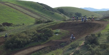
Welcome to Metcalf Motorcycle County Park, the County park system's only off-road vehicle park. This 445-acre park is located in the grass covered hills of south east Santa Clara Valley. Motorcycle County Park offers trails for the advanced and beginner motorcyclist and ATV rider. In addition to the 17 miles of dirt trails, there are motocross tracks, ATV tracks, a Quarter Midget track, picnic areas, air/water station, loading ramp, and restroom facilities.
Metcalf Motorcycle Park is partially funded by a grant from the California State Parks Off-Highway Motor Vehicle Recreation Division which supports maintenance, operations, and improvements for the park. The park receives grant funding for three project types: law enforcement, education and safety, and ground operations.
How to Get There
Metcalf Motorcycle County Park is located at:
300 Metcalf Rd San Jose, CA 95138
Park Office: (408) 226-5223
The park is located in the foothills off Metcalf Road in south San Jose east of US Highway 101. The park may be accessed from the Bernal Road exit off Highways 101 and 85. From the Bernal Road exit, proceed west about 0.2 miles to Monterey Highway south. Take Monterey Highway south 1.25 miles to Metcalf Road. Turn left and proceed up Metcalf Road 2.5 miles to the park entrance. Park will be on your right.
Activities
Metcalf Motorcycle County Park's 445 acres contain 17 miles of Off-Highway Vehicle (OHV) trail and tracks. Straddling a thousand foot high ridge, these park trails afford riders vistas ranging from Gilroy to San Francisco. The park facilities include:
- Motocross competition track
- Mini-motocross track (150cc four stroke or 100cc two stroke or less)
- Beginner's oval
- 12 miles of main trails (beginners/intermediate)
- 8 miles of single track enduro (expert) trails
- Hill climb area
- 3 Trials obstacle courses
- Shaded picnic areas, restrooms, visitor center, food/drink vending machines
- A 1/20th mile paved oval track operated by the Baylands Quarter Midget Racing Association, for quarter midget racing and practice.
In addition to a restroom building, there are picnic tables located at several locations. No tools will be loaned from the office.
View Metcalf Motorcycle County Park for current trail conditions, park hours and special events!
Hours and Fees
January: 8:00 a.m. - 5:00 p.m.
February: 8:00 a.m. - 5:30 p.m.
March: 8:00 a.m. - 6:00 p.m. (+ one hour for daylight savings = 7:00 pm)
April: 8:00 a.m. - 7:30 p.m.
May: 8:00 a.m. - 8:00 p.m.
June: 8:00 a.m. - 8:00 p.m.
July: 8:00 a.m. - 8:00 p.m.
August: 8:00 a.m. - 7:30 p.m.
September: 8:00 a.m. - 7:00 p.m.
October: 8:00 a.m. - 6:30 p.m.
November: 8:00 a.m. - 6:00 p.m. (- one hour for daylight savings = 5:00 p.m.)
December: 8:00 a.m. - 4:30 p.m.
The park is open Thursday through Monday and closed on Tuesdays and Wednesdays. The park is open on ALL holidays that do not fall on a Tuesday or Wednesday.
$6 per vehicle. Please have the required current registration properly displayed on each bike.
Access fees information here: Park Fees
Annual passes are available for purchase at the park. For more information, inquire at the park office or call the park office at the number noted above. If you plan on coming more than twice a month for the year, it will pay for itself.
Special Events
None are scheduled.
Junior OHV Ranger Program
Registration is now open for the Spring 2024 Junior OHV Ranger Program!*
Register here
*Registration is on a first-come, first-served basis, and participants must complete a registration form and liability waiver before participating in the five-session program.
Is your child curious about nature? Do they have a motorcycle and want to learn how to ride safely while also keeping our parks healthy? Then the Junior OHV Ranger program is for them!
In our free Junior Ranger OHV program at Metcalf Motorcycle Park, certified Motorcycle Safety Foundation (MSF) coaches will teach basic riding skills and discuss safety equipment, rider etiquette and trail conservation.
Participants must be ages 9-12 and own a motorcycle.
Upon completion of the five free sessions, each Junior OHV Ranger will receive a badge, jersey, and certificate.
Required gear for all sessions (except for first session on March 23):
1. DOT-Approved Helmet
2. Eye Protection
3. Gloves
4. Over the Ankle Boots
5. Long-Sleeved Shirt and Long Pants
6. ***All bikes need to be in working order and have fuel***
Spring Session 2024 Details:
-
Session 1: Saturday, March 23 (9-11am) (No motorcycle/gear needed on Day 1)
-
Hats of a Ranger, Safety Orientation, Wildlife Detectives
-
-
Session 2: Saturday, April 6 (9-2pm)
- MSF (Motorcycle Safety Foundation) Certification
- Session 3: Saturday, April 13 (9-11am)
- Trail ride practicing new skills, reinforcing T-Clock, Stewardship
- Session 4: Saturday, April 20 (9-11am)
- Trail ride practicing new skills, Rider Etiquette, Situation Awareness, Practice Safety Scenarios
- Session 5: Saturday, April 27 (9-11am)
- Trail ride practicing new skills on Riddle Ride
Training
The Novice Oval will be closed during ATV training. For more information on ATV training, call 1-800-887-2887 or visit www.atvsafety.org. Motorcycle training information, call 1-887-288-7093 or visit www.dirtbikeschool.com.
OHV Requirements
As a Santa Clara County Parks & Rec requirement, all OHV users must wear a Department of Transportation (DOT) approved helmet at all times while operating the vehicle on the park premises. SCC ORD B14-45.1(b)(2) Motorcycle Park-Helmet Required
For your safety and the safety of others, Off-Highway Vehicles must never be operated in a manner likely to endanger any person or property.
State and Federal law prohibit operating any vehicle while under the influence of alcohol or drugs. This applies equally to the operation of Off-Highway Vehicles, including those statues prohibiting drinking while driving (CVC 23220), and drinking in a motor vehicle (CVC 23221).
Motorcycles and ATVs must meet state sound requirements.
OHV Sound Regulation & Enforcement
On January 1, 2003, California off-highway vehicle noise regulations changed. If your off-highway vehicle was manufactured:
If your competition* off-highway vehicle was manufactured
Off-Highway Vehicles must not be operated in a manner creating off-trail damage or disturbance to soil, vegetation, or wildlife resources. Excessive OHV related damage to forest resources could lead to temporary or permanent closures.
OHV Registration
California residents must have a Green Sticker, Red Sticker, or current highway license plate for all motor vehicles being operated on public lands. Registration Identification Certificate must be kept with the vehicle along with the Identification, Green or Red Sticker. CVC 38085 Identification Certificate Kept with Vehicle.
California Green Sticker or Red Sticker:
If you are going to operate a motorized vehicle off-highway only, you must have either a current non voided Green or Red Sticker that has been issued by the DMV. The Green Sticker allows vehicles to operate on public land all year. The Red Sticker is for motorcycles and ATVs model year 2003 and newer that do not meet the emission standards established by (CARB) California Air Resources Board. If the vehicle has a 3 or a C in the eighth position of the (VIN) Vehicle Identification Number, then it does not meet the emission standards and should be issued a Red Sticker. The Red Sticker is exactly the same as the Green Sticker EXCEPT that these vehicles can only be operated during certain times of the year.
MOTORCYCLE/ATV (OHV) COUNTY PARK – RED STICKER SEASON
Off-Highway Vehicles that have been issued a Red Sticker can operate from:
OCTOBER 1 – APRIL 30.
RED STICKER OFF-HIGHWAY VEHICLES MAY RIDE ALL YEAR ON PRIVATE PROPERTY AND IN MOST NATIONAL FORESTS. Always call ahead before you plan a trip!
GREEN STICKER OR RED STICKER PLACEMENT REQUIREMENT:
Newly purchased OHVs must have proof of temporary registration or current registration in the new owner’s name.
***APPLYING YOUR REGISTRATION STICKER***
For better adhesion, clean surface thoroughly, remove any old stickers. Note, once sticker has been placed, removing the sticker will void the registration sticker, this now is no longer a valid sticker. (CVC) 38090 Lost or Mutilated/illegible ID Plate
A Green or Red Sticker can be applied to a fork sleeve and attached to the fork to preserve the sticker from damage. The fork sleeve with sticker MUST BE APPLIED TO FORK WITH A PIPE CLAMP to meet CVC 38170(b) Off-Highway Vehicles; I.D. Plate Display
Non-Resident Permits
All vehicles operated off-highway on public lands in California are required to be (1) street-licensed or(2) registered as an off-highway vehicle (OHV), If you are visiting California from another state and your vehicle does not have a current registration from your home state, you MUST purchase a California Non-Resident OHV Use Permit before you recreate on public lands. The permit fee is $30. CVC38087.5 Off-Highway Motor Vehicle; Non Resident Permits
Nonresident Permit Vendor List (PDF)
OHV Permit Order Form (PDF)
Arizona Visitors
Please refer to the Arizona OHV Decal Program web page for updated information.
Spark Arrestors
Off-Highway Vehicles MUST be equipped with a properly installed United States Forest Service (USFS) approved spark arrestor, maintained in effective working order. (CVC 38366 (b)) Spark Arrester
Only motorcycles are allowed on the Motocross Track and on the expert trails. No ATVs or ATCs are permitted on the Motocross Track or expert trails (black diamond).
Appropriate Safety Gear
We only require an OHV rider to wear a fastened DOT approved helmet. Although we recommend each rider equips themselves with all of the gear listed below.
Trail Markings
All trails are one way. Proper direction of travel and trail difficulty will be indicated on carsonite posts and will appear as follows:
RIDE AT YOUR OWN RISK AND
WEAR REQUIRED SAFETY EQUIPMENT
Off-highway vehicle use may be hazardous. Use of protective apparel, skill levels, vehicle condition, terrain, weather, common sense and following the park rules, all affect your safety.
Electric Off-Road Bikes
Electric off-road bikes with foot pegs are allowed at Metcalf Motorcycle Park. Electric off-road bikes with pedals are not allowed at the park.
Electric off-road bikes are like dirt bikes and ATV’s and must be registered with the DMV to ride at OHV Parks. Some brands of electric off-road bikes only come with a 15-digit serial number and may require a 17-digit VIN (Vehicle Identification Number) to be assigned by the California Highway Patrol. Contact the California Highway Patrol for further information or to make an appointment.
Moped plates are not vehicle registration fees for electric off-road bikes, however dual registration can be obtained. See DMV website for specific requirements on registration.
https://www.dmv.ca.gov/portal/vehicle-registration/new-registration/motorcycles-mopeds-and-scooters/
Before You Head To The Park
Attachments:
7850 Pole Line Rd
Watsonville, CA 95076
Trail Closure Notice: The following trails are closed - Loop Trail between Mt. Madonna Rd and Junction 24, Blackhawk trail between Junction 77 and 83, Redwood trail is closed between Junction 69 and 70, and in the Inspiration Point Area all trails are closed.
NOTE: County Parks is improving the health and safety of the natural forest at Mt. Madonna through several tree trimming and removal projects this year. During your stay you may see or hear people and equipment working on the Mt. Madonna Forest Health Plan. Beginning Summer 2023 and extending into Fall 2024, work will occur in several locations in the park. We appreciate your patience and understanding as this project contributes to the long-term health and vitality of the Mt. Madonna Forest. For more information, please visit https://parks.sccgov.org/forest-health
Welcome to Mt. Madonna County Park, one of the most majestic of Santa Clara County's regional park and recreation areas. This 4,605-acre park is dominated by the redwood forest so characteristic of the Santa Cruz Mountain range. To the east, the park overlooks the Santa Clara Valley, to the west, Monterey Bay. As the slopes of Mt. Madonna descend toward the valley, the landscape changes from redwood forest to oak woodland, dense chaparral and grassy meadows. Park visitors may learn about areas where Ohlone Indians hunted and harvested, and will understand why cattle baron Henry Miller spent his summers here. Enjoy your visit today, and return often to the pristine redwood forest of Mt. Madonna County Park. Mt. Madonna Stables offers horseback trail rides, it is a wonderful way to explore the beauty of this park.
How to Get There
Mt. Madonna County Park is located at:
7850 Pole Line Rd Watsonville, CA 95076
Park Office: (408) 842- 2341
The park is located on Highway 152 (Hecker Pass Highway), 10 miles west of Gilroy. From the east, use Highway 101, and take the Highway 152 West exit. From the west, use Highway 1, and take the Highway 152 East exit. The entrance to the park is located at the summit of Highway 152 at Pole Line Road.
If camping, please follow the directions listed above. Pole Line Road is recommended for trailers. Following Google Maps may not provide the most accurate directions.
Activities
Hikers and equestrians have access to an extensive 14 mile trail system. Mt. Madonna Stables offers horseback trail rides, it is a wonderful way to explore the beauty of this park. A one mile self-guided nature trail winds around the ruins of cattle baron Henry Miller's summer home.
Bowmen may practice archery skills at the beautiful archery range.
The park's amphitheater is available by reservation for weddings and other special functions. The park also features a visitor center where the natural history, geology and cultural history of the park is highlighted.
Visitors may choose from 116 drive-in and walk-in reservable campsites spread throughout four campgrounds. Each site comes equipped with a barbecue pit, food locker, and picnic table. Showers are also available (no coins needed) for campers (camping fee required for use of showers), as well as 29 partial hook-up RV sites. Yurts are also available for reservation. These domed-tent like structures come in three different sizes - 16', 20' and 24' offering bunk beds with mattresses, fold out futons and a wrap-around deck.
Overnight camping is one of the most popular activities at Mt. Madonna. View here for more information about tent, yurt and RV camping. There is no longer first-come, first-serve camping sites.
Shaded picnic areas are available on a first-come, first-served basis. Group picnic, group camping and youth camping areas are available by reservation.
Check the Events Calendar for public programs and events at Mount Madonna and other Santa Clara County Parks.
Mt. Madonna Pathways of Wildlife Hiking Trails
Mt. Madonna County Park has created the Pathways of Wildlife hiking trails. Hikers can choose from four trails depending on their interests and hiking skill level. You can follow the path of the Banana Slug, California Newt, Gray Fox, or Mountain Lion! The family friendly California Newt trail is tied to the Agents of Discovery activity for mobile devices. There are colored markers at each intersection to help guide hikers along the trails. You can find the start of the hikes uphill from the Visitor Center/Ranger Station near the entrance to the Henry Miller Site.
Agents of Discovery
Agents of Discovery is a free educational mobile game you can play while hiking along the Pathways of Wildlife "CA Newt Trail." It is a 1.5 mile loop and may take you about 1hr – 1 hr 15 min to complete. You can start near the Visitor Center/Ranger Station. Along the trail you will use your smart phone or tablet to answer questions about the natural, cultural, and historic resources here within the Redwood forest ecosystem at Mount Madonna County Park. We recommend you download the Agents of Discovery app from the Google Play or App Store, as well as the Mt. Madonna mission within the app, before you head out to the park. A prize is available if you complete the mission - further details on how to receive your prize are listed within the app, once you complete all the questions. It is available to play in English and Spanish. Questions? Email [email protected].
Hours and Fees
The park is open year-round from 8 a.m. until sunset. All non-campers must leave the park before sunset. Vehicle entry fees are collected year-round. Fees are required for camping, and for use of group picnic and group camping areas. Fees are posted at the kiosk and at the ranger station.
Access fees information here: Park Fees
Accessibility
In compliance with the requirements of Title II of the Americans with Disabilities Act of 1990 ('ADA'),the Santa Clara County Parks and Recreation Department will not discriminate against qualified individuals with disabilities on the basis of disability in its programs, services, or activities. The Department will make reasonable modifications to policies and programs to ensure that people with disability have an equal opportunity to enjoy our programs, services, facilities, and activities. If you need assistance with an ADA request, please contact our ADA Coordinator.
Additional Documents:
Mabury Rd & Jackson Ave
San Jose, CA 95112
Welcome to Penitencia Creek County Park. This 163 acre linear park and regional trail incorporates parklands and open space from a number of agencies including Santa Clara County, the City of San Jose and the Santa Clara Valley Water District. This four-mile trail follows Penitencia Creek from the 700-acre Alum Rock Regional Park (City of San Jose) to its confluence with Coyote Creek. The trail is incomplete at this time, however, a majority of the trail is developed and is open to public use and enjoyment.
How to Get There
Penitencia Creek County Park is located at:
Mabury Rd & Jackson Ave San Jose, CA 95112
Park Office: (408) 262-6980
From U.S. 101:
To reach the park chain from U.S. Highway 101 take the McKee Road exit in San Jose. Travel east on McKee 1.2 miles to Jackson Avenue. Turn left on to Jackson and proceed 0.7 miles to Mabury Road. The Penitencia Creek County Park gardens and access point to the trail are located on the northwest corner of Jackson and Mabury. The trail crosses Jackson Avenue 0.2 miles north of Mabury on the south side of Penitencia Creek. Penitencia Creek Road parallels the trail form Capitol Avenue to Alum Rock Park. To reach the City of San Jose's Penitencia Creek Park, take the McKee Road exit east. Follow McKee Road 1.8 miles to Capitol Avenue, turn left on to Capitol. Travel north on Capitol 1.2 miles to Penitencia Creek Road. Turn right and proceed east to the park's entrance of the left.
From I-680:
To reach the park chain from Interstate 680, take the Berryessa Road exit and proceed east 0.2 miles to Capitol Avenue. Turn right and follow Capitol Avenue south 0.4 miles to Penitencia Creek Road. You may either follow Penitencia Creek Road to the City of San Jose's Penitencia Creek Park or continue on Capitol Avenue south 0.4 miles to Mabury Road in order to reach the Penitencia Creek Gardens. Turn right on to Mabury and travel west 0.5 miles to Jackson Avenue. The Penitencia Creek County Park Gardens and access point to the trail are located on the northwest corner of Jackson and Mabury. The trail crosses Jackson Avenue 0.2 miles north of Mabury Road, on the south side of Penitencia Creek.
Activities
Penitencia Creek Park is an 163 acre part of a parkway project owned and operated by several agencies. The parkway begins with the City of San Jose's 700 acre Alum Rock Regional Park. This park offers opportunities for hikers, bikers, and nature lovers. The park incudes a nature center and picnic grounds. The trail proceeds intermittently from Alum Rock Park. Some portions of the trail are as yet undeveloped. Between Alum Rock Park and Noble Avenue, trail users must use the road shoulder. This is also the case between Noble Avenue and White Road/Piedmont Road, however, sidewalks and bike paths fill in the gaps. The trail from White/Piedmont Roads to Jackson/Mabury area is continuous except for the on-street crossings of Capitol Avenue and Jackson Avenue. The paved trail provides opportunities to hikers, bicyclists and skaters/bladers. The creek flows westerly through the residential neighborhoods of Berryessa and Alum Rock to its confluence with Coyote Creek near Berryessa Road. The trail between Jackson/Mabury and Coyote Creek is as yet largely undeveloped.
Hours and Fees
The park is open year round form 8:00 a.m. until sunset. The ranger station for Penitencia Creek County Park is located at Ed R. Levin County Park in Milpitas (408) 262-6980. No fees are collected at this facility.
Accessibility
In compliance with the requirements of Title II of the Americans with Disabilities Act of 1990 ('ADA'), the Santa Clara County Parks and Recreation Department will not discriminate against qualified individuals with disabilities on the basis of disability in its programs, services, or activities. The Department will make reasonable modifications to policies and programs to ensure that people with disability have an equal opportunity to enjoy our programs, services, facilities, and activities. If you need assistance with an ADA request, please contact our ADA Coordinator.
Attachments:
22500 Cristo Rey Dr
Cupertino, CA 95014
Welcome to Rancho San Antonio County Park, one of Santa Clara County's most popular parks. The County of Santa Clara Parks and Recreation Department leases Rancho San Antonio County Park to Midpeninsula Regional Open Space District (MROSD). This 165-acre County Park, combined with the adjacent 3,988-acre Midpeninsula Regional Open Space Preserve, provides 24 acres of trails and other recreational features. Through a lease agreement, MROSD now manages the entire park. For information, please call (650) 691-1200.
Carpool parking lot pilot program begins September 3, 2022
Beginning September 3, parking lot 1 will be limited to carpools of three or more individuals on weekends (Saturday and Sunday) and holidays. When in effect, the lot entrance will be monitored by seasonal ranger aides and enforced by ranger staff. ADA-accessible spaces and equestrian trailer parking will remain available for visitors. Parking lot 1 is located at the Coyote Trail trailhead, immediately west of the park entrance. In conjunction with the one-year carpool pilot program, new signage has been installed at the park entrance that displays real-time space availability in the parking lots within the county park. This real-time information is also displayed on the Midpen website at www.openspace.org/rsa-parking, so that visitors can check parking availability before their visit.
How to Get There
Rancho San Antonio County Park is located at:
22500 Cristo Rey Dr Cupertino, CA 95014
General Information: (650) 691-1200
Park Office: (650) 691-2165
Located in the foothills below Skyline Ridge in close proximity to Interstate 280 and the cities of Los Altos, Los Altos Hills, and Cupertino.
From Highway 85, north or south, take the Interstate 280 exit to San Francisco. From Interstate 280, north or south, take the Foothill Boulevard exit and proceed south on Foothill Boulevard approximately 0.2 miles to Cristo Rey Drive. Turn right on Cristo Rey Drive and proceed 0.9 miles to the park entrance. The nearest bus stop is located at Foothill Expressway at Cristo Rey Drive.
Activities
Rancho San Antonio County Park provides both formal and informal recreational opportunities. The most popular activities at Rancho San Antonio County Park are jogging and hiking. Stretching bars are available at the restroom parking area and equestrian staging area. The park provides hiking, bicycling and equestrian trails which connect with over twenty three miles of trails within Rancho San Antonio Open Space Preserve. Bicycles are restricted to paved trails only, namely the Rancho San Antonio Trail, and are not permitted west of Deer Hollow Farm in the Open Space Preserve. Similarly, equestrians are limited to the equestrian staging area and Coyote Trail. Equestrians are permitted on most trails in the Open Space Preserve.
The South Meadow area, adjacent to the parking areas, provides opportunities for informal play on a "rough grass" area. Non-gas powered model airplane enthusiasts use a staging area adjacent to the parking lots near the park entrance for take-offs and landings and fly their aircraft above the South Meadow area. The equestrian staging area is also located adjacent to the South Meadow which includes a horse watering trough.
The North Meadow area, across Permanente Creek from the parking and staging areas, provides an informal irrigated meadow grass play area. The North Meadow includes a small number of picnic tables and barbeques. One of the most popular destinations for school groups and families within the Open Space Preserve is the Deer Hollow Farm which is operated by the City of Mountain View. A variety of environmental and agricultural education programs are conducted here throughout the year. Deer Hollow Farm is closed on Mondays. For more information about Deer Hollow Farm, call (650) 903-6430.
No dogs are allowed at Rancho San Antonio County Park. For a map, visit Rancho San Antonio Open Space Preserve.
Hours
The park is open year-round from 8 a.m. to sunset.
Accessibility
In compliance with the requirements of Title II of the Americans with Disabilities Act of 1990 ('ADA'), the Santa Clara County Parks and Recreation Department will not discriminate against qualified individuals with disabilities on the basis of disability in its programs, services, or activities. The Department will make reasonable modifications to policies and programs to ensure that people with disability have an equal opportunity to enjoy our programs, services, facilities, and activities. If you need assistance with an ADA request, please contact our ADA Coordinator.
Related Links:
16055 Sanborn Rd
Saratoga, CA 95070
State Route 9 (SR-9) Closure Information: To reach the main entrance of Sanborn County Park, use Sanborn Rd off Route 9 from San Jose. Please note that Bohlman/McGill Road DO NOT provide access to Sanborn County Park. Follow the orange reroute signs for proper guidance.
State Route 9 (SR-9) from Sanborn Rd. to Redwood Gulch Rd. near Saratoga is closed due the highway being blocked by debris due to an unstable hillside. For more information on the Route 9 closure visit the CalTrans website or call 1-800- 427-ROAD.
Trail Closure: Summit Rock is closed daily through August 30, 2024, for Peregrine Falcon nesting season.
Fuel Reduction Closures: Sections throughout Sanborn County Park will be closed in rotation for periods of 4 to 6 weeks through the summer of 2024 for crucial fuel reduction projects for the Los Gatos Creek Watershed Forest Health Project. Hard closures on the John Nicholas Trail (between Black Road and Lake Ranch Reservoir/junction 76) and Lake Ranch Trail down to Sanborn Road will occur in late April as weather permits for approximately 3 days. Some temporary trail closures will occur intermittently during this period, resulting in delays of 15-20 minutes. This means that the section of John Nicholas Trail from Skyline to Lake Ranch Reservoir will not be a through trail during hard closures.
Pile Burn Notice: Santa Clara County Fire and County Parks will be conducting a pile burn operation at the Dyer House on Monday, April 22. There are no trail closures during pile burn operations. This project will increase the defensible space around the Ranger Office/Visitor Center and enhance forest health.
Welcome to Sanborn County Park. This lushly wooded park of 3,453 acres is nestled in the Santa Cruz Mountains between Saratoga and Skyline Boulevard. This mountain park of redwoods and tan bark oak offers hiking, hike-in camping, RV camping, and picnicking opportunities year-round. Enjoy your visit today and return often to experience the many features of Sanborn County Park.
How to Get There
Sanborn County Park is located at:
16055 Sanborn Rd Saratoga, CA 95070
Park Office: (408) 867-9959
Sanborn County Park is located on Sanborn Road. From Saratoga, proceed 2 miles west on Highway 9 to Sanborn Road. Turn left onto Sanborn Road, traveling 1 mile to the park entrance.
Restricted Parking on Black Road (Map): To improve traffic flow for area residents and visitors at Sanborn County Park, the Santa Clara County Board of Supervisors unanimously adopted resolutions restricting parking on Black Road. Press Release
Resolutions were also adopted in 2023 for parking restrictions at the far south end of Sanborn Road (no parking due to single-lane road/safety issues) near the entrance to Lake Ranch Trail.
Activities
Hikers, picnickers, RV & hike-in campers, will find Sanborn Park has much to offer. For experienced hikers, Sanborn Park has over 22 miles of trails that showcase the geographic features of the park. The Lake Ranch Trail offers a shaded, easy hike between Lake Ranch and Black Road.
The day use area offers a variety of amenities. A one mile nature trail is available to the park visitor which provides an excellent example of the flora and fauna to be found in the park. Picnic tables are available year round in the forty-acre, grass covered, day use area. For large gatherings, there are three group areas available by reservation. For reservations, please call (408) 355-2201. During the summer months the park is home to the only outdoor Shakespearean company in Silicon Valley. Silicon Valley Shakespeare has been delighting audiences with outstanding productions of the works of Williams Shakespeare. For more information about Silicon Valley Shakespeare, visit their website at www.svshakespeare.org.
An RV campground, open year-round, offers electric and water hook-ups and a dump station. Vehicle length limit is 30 feet. Reservations can be made for RV camping and Hike-in tent camping online at www.parkhere.org or by calling (408) 355-2201. Hike-in tent camping is closed each year from the third Sunday in October until the third Friday in March.
NO CAR CAMPING AT SANBORN PARK.
Visit Go Outside and Play to make a reservation - we highly encourage them!
Camping
Welcome to Sanborn Park campground. NO CAR CAMPING AT SANBORN PARK. The park offers both RV and “hike-in” campgrounds.
RV campgrounds are open, walk-in campgrounds are open.
To ensure that your stay is safe and enjoyable, please follow these campground rules:
- Gate closes at sunset. Re-entry is allowed for campers. Campers must ask Sanborn Park Staff for the current gate combination when they arrive at the park.
- Quiet hours are from 10 p.m. to 8 a.m. Please respect your neighbors.
- Two vehicles allowed per campsite. Vehicles permitted at $10 per vehicle.
- Maximum capacity per site: RV site - 8 persons. Hike-in sites - 6 persons.
- Two campsite maximum allowed per person/household.
- Camping length of stay limit:
Memorial Day through Labor Day - 14 days maximum
Remainder of year - 14 days within a 45 day period
Hike-in tent camping is closed from the third Sunday in October until the third Friday of March. - Persons under 18 years of age may not camp without an adult.
- Pets are allowed in designated areas and the campground. They must be leashed at all times. Pets may not be left unattended or in your vehicle and must be confined at night.
- Bicycles are allowed in RV and picnic sites only. No riding in hike-in campground or on trails.
- Fires are permitted in designated fire rings only. Do not gather wood. Extinguish fires when unattended. When posted "NO FIRES", only camp stoves or gas grills are permitted.
- Check out time is 1:00 p.m.
- Camp in designated sites only.
- Tents are allowed in the hike-in sites only; no tents in the RV sites.
- Do not dig or level the ground around tents or campsites.
- Garbage must be disposed of immediately. Keep your site clean.
- Do not pick, collect or remove flowers, foliage, berries, wood, animals, insects, or other items from the park.
- Do not damage any park property or vegetation with nails, wire, rope, knives, saws, paint, or other objects.
- Do not feed animals or birds for your safety and their health.
Hours and Fees
The park is open year round from 8:00 a.m. to sunset. Vehicle entry fees are collected year round. Fees are also required for RV camping, hike-in camping and group picnic areas.
Access fees information here: Park Fees
Accessibility
In compliance with the requirements of Title II of the Americans with Disabilities Act of 1990 ('ADA'), the Santa Clara County Parks and Recreation Department will not discriminate against qualified individuals with disabilities on the basis of disability in its programs, services, or activities. The Department will make reasonable modifications to policies and programs to ensure that people with disability have an equal opportunity to enjoy our programs, services, facilities, and activities. If you need assistance with an ADA request, please contact our ADA Coordinator.
Attachments
260 Bernal Rd
San Jose, CA 95119
Bernal Entrance Alert: The restrooms and water fountain are currently out of order at the Bernal-Gulnac Joice Ranch Entrance. Portable toilets and sink are available for use. There is no potable water available.
Welcome to Santa Teresa County Park located in the Santa Teresa Hills ten miles south of downtown San Jose. This diverse 1,673 acre park, rich in history, offers spectacular views from its trails above the Almaden and Santa Clara Valleys. The secluded upland valleys of the park provide a quiet interlude for exploring the natural environment minutes away from the surrounding developed areas.
How to Get There
Santa Teresa County Park is located at:
260 Bernal Rd San Jose, CA 95119
Park Office: (408) 225-0225
The Ranger Station for Santa Teresa County Park is located at Hellyer County Park.
Santa Teresa County Park is located at the southern end of the Santa Teresa Hills. The park may be accessed from either Almaden Valley or Santa Clara Valley. From Santa Clara Valley, take US 101 or Highway 85 to the Bernal Road exit. Proceed west 1.3 miles on Bernal Road and cross Santa Teresa Boulevard toward the Santa Teresa Hills. Bernal Road continues past the park's Santa Teresa Golf Club, winding up into the hills. The Pueblo Day Use Area is located off Bernal Road in a small open valley in the hills. Limited parking and trailhead access are available from Almaden Valley. From San Jose, follow Almaden Expressway until it ends. Turn right onto Harry Road, then turn left onto McKean Road. Travel approximately 1.3 miles to Fortini Road. Turn left onto Fortini Road toward the Santa Teresa Hills. At the end of Fortini Road, turn left onto San Vicente Avenue. A ten car parking area is located on the right about 500 feet from Fortini Road. Public transit is available to Santa Teresa County Park.
Activities
Santa Teresa County Park offers a variety of recreational opportunities. The Santa Teresa Golf Club, operated by a concessionnaire, offers an 18 hole championship course and a 9 hole/par three course. The clubhouse includes a restaurant and pro shop. Electric carts are available for a fee. Also located in the golf course is a banquet facility, available by reservation. For green fee rates, reservations and more information about the golf course, call (408) 225-2650 or visit Santa Teresa Golf Club.
The Pueblo Day Use Area includes parking for over 170 vehicles and an equestrian staging area. A reservable group picnic area for up to 100 people with a large barbeque pit is sited near a restroom facility and potable water source. Other individual picnic tables and barbeques are scattered throughout the day use area.
The historic Bernal-Gulnac-Joice Ranch and Santa Teresa Springs are open to the public and available for school tours. For more information on school tours, please visit our education page.
An archery range, operated and maintained by the Black Mountain Bowmen Archery Club, is open for public use except when tournaments are scheduled.
The park offers over 17 miles of unpaved trails for equestrian, hiking and bicycle use. Some of the trails are steep, namely around Coyote Peak. The Coyote Alamitos Canal is a Santa Clara Valley Water District facility. The canal includes a maintenance road which is not part of the park's trail system. Spectacular wildflower displays may be found from March through June on the Stile Ranch Trail as well as many other trails in the park.
The park also features an annual event at Bernal-Gulnac-Joice Ranch called La Fuente. This year it is scheduled for Saturday, September 23rd, and will feature dancing, music, community tables, and history walks.
Picnicking
Picnicking by groups and families is a popular activity in Santa Teresa County Park, namely in the Pueblo Day Use area. Please help make this experience enjoyable for everyone by adhering to the following rules and any posted regulations:
- Picnic tables are available on a first-come, first-served basis.
- The Pueblo Group Area is available for groups up to 100 persons. To reserve this facility, please call (408) 355-2201, 8:30 a.m. to 3:30 p.m., Monday through Friday.
- Parking is available on a first-come, first-served basis only. Reservations at group area does not include reserved parking.
- Do not drive into picnic areas or onto lawns or paths.
- Twenty minutes is the maximum time allowed for parking in the yellow zone for unloading and loading of picnic supplies.
- No tacks, nails, or staples on park signs, tables, or trees.
- Allow fires in barbecue pits to burn out. Water will damage the grill and pit.
- Amplified music is allowed.
Hours and Fees
The park is open year-round from 8 a.m. until sunset. Vehicle entry fees are collected year-round. Fees are required to reserve the Pueblo Group Picnic Area. For green fees and other information regarding the golf club, call (408) 225-2650 or visit their website.
Access fees information here: Park Fees
Accessibility
In compliance with the requirements of Title II of the Americans with Disabilities Act of 1990 ('ADA'), the Santa Clara County Parks and Recreation Department will not discriminate against qualified individuals with disabilities on the basis of disability in its programs, services, or activities. The Department will make reasonable modifications to policies and programs to ensure that people with disability have an equal opportunity to enjoy our programs, services, facilities, and activities. If you need assistance with an ADA request, please contact our ADA Coordinator.
Additional Documents:
11401 Stevens Canyon Rd
Cupertino, CA 95014
Stevens Creek Celebrates 100 Years: On January 24th, 1924, the County acquired a 400 acre parcel in Cupertino that became Stevens Creek County Park. We're celebrating 100 years of Stevens Creek to honor the visionary initiative that started the preservation movement in Santa Clara County. Watch the Video
Boating and recreational water activities (non-power/hand launch only) opened for the season on April 13, 2024. Hours are 8:00 am to 30 minutes prior to sunset.
Welcome to Stevens Creek County Park. The beautiful 1,063-acre park offers widely diverse recreational amenities, including the 87-acre reservoir. Visitors may enjoy exploring the remnants of the historic Villa Maria orchard.
How to Get There
Stevens Creek County Park is located at:
11401 Stevens Canyon Rd Cupertino, CA 95014
Park Office: (408) 867-3654
Stevens Creek County Park is located along Stevens Canyon Road and Mt. Eden Road in the foothills between Saratoga and Cupertino. To access the park from Cupertino, take Interstate Highway 280 to Foothill Expressway. Follow Foothill Blvd west three miles to the northern park entrance (Foothill Blvd changes into Stevens Canyon Road as it crosses McClellan Road). From Saratoga, travel north on Highway 9 to Pierce Road. Turn onto Pierce Road and travel 1.8 miles to Mt. Eden Road. Turn left onto Mt. Eden Road and travel 1.5 miles to the south park entrance.
Upper Stevens Creek County Park is located at:
Skyline Blvd Palo Alto, CA 94034
Park Office: (408) 867-9959
Upper Stevens Creek Park may be accessed from Skyline Blvd (Hwy 35). A parking area is located approximately 3 miles south of Page Mill Road and 3.2 miles north of Highway 9. Upper Stevens Creek Park may also be accessed by foot, horse or bicycle from Stevens Canyon Road or the connecting Mid-Peninsula Open Space lands and trails. Public transit is available to Stevens Creek County Park.
Activities
Stevens Creek Reservoir is an 87-acre, non-power boating reservoir popular with fisherman and boaters. Anglers may fish for black bass, large-mouth bass, catfish and crappie. Sailors, kayakers and non-power boaters may enjoy a beautiful view from the calm waters of Stevens Creek Reservoir. Call (408) 355-2201 to make a boating and boat inspection reservation or go online at Go Outside and Play.
Shoreline picnic facilities are available at the very popular Lakeshore Picnic area. Six beautifully shaded first-come, first-served picnic areas are scattered throughout the park. Three of the picnic sites are located along Stevens Creek. Two group picnic areas are available by reservation for group functions.
Hikers, bikers and equestrians may enjoy a variety of over nine miles of single track and multi-use trails. Solitude may be found along many of the trails which connect with the Mid-Peninsula Open Space Fremont Older Preserve. Mountain bicycling is one of the more popular recreational activities at Stevens Creek Park.
Upper Stevens Creek County Park may be accessed through Stevens Creek County Park and functions as one of a chain of many publicly owned lands located along the peninsula skyline. The Bay Area Ridge Trail also passes through Upper Stevens Creek County Park.
If you prefer horses, there are many miles of trails to traverse. Horses are available for rent at Garrod Stables located just outside the south entrance on Mt. Eden Road. Check out Garrod Farms for horse rentals.
Archery enthusiasts may practice their skills along the 28-station roving archery course and range which is open to the public.
Stevens Creek County Park is also one of the most popular birding parks in the Bay Area. Over 125 species have been sighted and recorded to date.
The ranger station, located at the north entrance to the park, provides maps and displays for visitors.
Picnicking
Picnicking by families and groups is one of the most popular activities at Stevens Creek County Park. Help make this experience enjoyable for everyone by adhering to the following rules and any posted regulations:
- Picnic tables are available on a first-come, first-served basis. A responsible adult (with picnic items) must be present in order to hold a picnic table.
- Reservations are recommended for groups larger than twenty. Call (408) 355-2201, 9am to 4pm, Monday through Friday.
- Parking is available on a first-come, first-served basis only. Parking stalls may not be saved. Reservations at group areas do not include reserved parking.
- Do not drive into picnic areas or onto lawns, paths, or landscaping.
- Twenty minutes is the maximum time allowed for parking in a yellow zone for unloading and loading of picnic supplies.
- Post directional signs in designated areas only.
- No tacks, nails, or staples on park signs, tables, or trees.
- Allow fires in barbecue pits to burn out. Water will damage the grill and pit.
- Amplified music is prohibited without a permit.
Hours and Fees
The parks are open year-round from 8am until sunset. Boats must be off the water 30 minutes before sunset. Lake use and vehicle entry fees are collected daily at the Chestnut Parking Lot. Fees are also required for group picnic reservations.
Access fees information: Park Fees
Accessibility
In compliance with the requirements of Title II of the Americans with Disabilities Act of 1990 ('ADA'), the Santa Clara County Parks and Recreation Department will not discriminate against qualified individuals with disabilities on the basis of disability in its programs, services, or activities. The Department will make reasonable modifications to policies and programs to ensure that people with disability have an equal opportunity to enjoy our programs, services, facilities, and activities. If you need assistance with an ADA request, please contact our ADA Coordinator.
Attachments:
999 E Caribbean Dr.
Sunnyvale, CA 94089
Welcome to Sunnyvale Baylands Park, operated by the City of Sunnyvale. This park has a unique blending of natural preserved wetland areas, with the picnic and playground features of a traditional community park. Adjacent to the park is the Twin Creeks Sports complex. Baylands Park provides over seventy acres of developed parkland offering active recreation, pathways and picnic areas for families and large groups. An additional 105 acres of seasonal wetlands is protected as a Wetlands Preserve providing habitat for plants and wildlife.
How to Get There
Sunnyvale Baylands Park is located at:
999 E Caribbean Dr Sunnyvale, CA 94089
Park Office (Operated by City of Sunnyvale): (408) 730-7350
Hours and Fees
The park is open year-round from 8 a.m. until sunset. County Parks annual vehicle passes are not accepted at this park. Seasonal passes for this park are available through the City of Sunnyvale. A vehicle entry fee is collected at the entrance.
Accessibility
In compliance with the requirements of Title II of the Americans with Disabilities Act of 1990 (‘ADA'),the Santa Clara County Parks and Recreation Department will not discriminate against qualified individuals with disabilities on the basis of disability in its programs, services, or activities. The Department will make reasonable modifications to policies and programs to ensure that people with disability have an equal opportunity to enjoy our programs, services, facilities, and activities. If you need assistance with an ADA request, please contact our ADA Coordinator.
Skyline Blvd
Palo Alto, CA 94034
Welcome to Upper Stevens Creek County Park. This 1,280 acre Santa Cruz Mountains redwood park offers a wilderness experience for visitors interested in the park's mature stands of douglas firs and redwoods.
How to Get There
Upper Stevens Creek County Park is located at:
Skyline Blvd Palo Alto, CA 94034
Park Office: (408) 867-9959
Upper Stevens Creek Park can be accessed from Skyline Blvd (Hwy 35). A parking area is located approximately 3 miles south of Page Mill Road and 3.2 miles north of Highway 9. Upper Stevens Creek Park may also be accessed by foot, horse or bicycle from Stevens Canyon Road or the connecting Mid-Peninsula Open Space lands and trails. Public transit is available to Stevens Creek County Park.
Activities
The park is also popular with mountain bicyclists and for its 12.6 miles of long hiking trails and valley vistas. This park offers lush, densely wooded trails for a variety of users. The unique combination of recreational resources and natural beauty make Upper Stevens Creek County Park a magnet for hikers, bicyclists, equestrians, and nature lovers.
Hours and Fees
The parks are open year round from 8 a.m. until sunset.
Accessibility
In compliance with the requirements of Title II of the Americans with Disabilities Act of 1990 (‘ADA'),the Santa Clara County Parks and Recreation Department will not discriminate against qualified individuals with disabilities on the basis of disability in its programs, services, or activities. The Department will make reasonable modifications to policies and programs to ensure that people with disability have an equal opportunity to enjoy our programs, services, facilities, and activities. If you need assistance with an ADA request, please contact our ADA Coordinator.
Attachments:
8515 Croy Rd
Morgan Hill, CA 95037
Welcome to Uvas Canyon County Park. This lushly wooded park of 1,147 acres, is nestled in upper Uvas Canyon on the eastern side of the Santa Cruz Mountains. This mountain park offers hiking, camping and picnicking opportunities throughout most of the year. Enjoy your visit today and return often to experience the many features of Uvas Canyon County Park.
A Parking Reservation must be made before entering Uvas Canyon. Reservations are required seven (7) days a week including weekends and holidays. Reservations for parking can be made by visiting our website https://gooutsideandplay.org and selecting "Day Passes".
Annual Parking Pass Reservations - Passholders may purchase a Uvas Day Pass online and request a $6 refund by emailing the Reservation Office, [email protected], with your receipt number as well as your Annual Parking Pass Number. You may also call the Reservation Office at 408-355-2201 and provide the agent with your Annual Parking Pass number and the agent will reserve your Uvas Day Pass.
Confirmation of your reservation must be printed and placed on your dashboard when parked inside of Uvas Canyon County Park.
Please visit https://gooutsideandplay.org to make your reservation.
How to Get There
Uvas Canyon County Park is located at:
8515 Croy Rd Morgan Hill, CA 95037
Park Office: (408) 779-9232
Uvas Canyon County Park is located at the end of Croy Road in Uvas Canyon. From Highway 101, take Bernal Road west. Turn left on Santa Teresa Boulevard. Travel south 3 miles and turn right onto Bailey Avenue. Follow Bailey Road 2.3 miles to McKean Road. Turn left onto McKean Road (McKean Road becomes Uvas Road 2.2 miles south of Bailey Road). From Bailey Road travel 6 miles south on McKean/Uvas Road and turn right onto Croy Road. Continue 4.4 miles on Croy Road, through Sveadal, to reach the Park entrance. Sveadal is a private resort belonging to the Swedish American Patriotic League. Please respect their privacy and drive slowly as you pass through Sveadal.
If camping, please follow the directions listed above. Croy Road is the ONLY entrance to Uvas Canyon. Following Google Maps may not provide the most accurate directions.
Activities
Outdoor enthusiasts will find Uvas Canyon Park has much to offer. The park has 7 miles of hiking trails including a one mile Waterfall Loop that travels along Swanson Creek past many of the park's waterfalls. A pamphlet, available at the trailhead and/or ranger's office, highlights the flora of Uvas Canyon along this self-guided interpretive trail. The park contains individual picnic sites available on a first come, first served basis. The Black Oak Group Picnic Area is available by reservation for groups up to 75 people. The campground has 25 individual campsites and showers. Reservations are highly recommended. The Upper Bench Group Camping Area is reservable for up to 50 people. No swimming is permitted in any of the Santa Clara County Parks.
Camping
Welcome to Uvas Canyon County Park campground. To ensure that your stay is safe and enjoyable, please follow these campground rules:
- Gate closes at sunset. No re-entry after gates are closed.
- Quiet hours are from 10 p.m. to 7 a.m. Please respect your neighbors.
- Each campsite is limited to no more than eight (8) persons.
- Two campsite maximum per person/household allowed.
- Due to space constraints of internal park roads, there is a 12 foot maximum for all RV's and trailers.
- Flush toilets and running water are available. Showers are available.
- A maximum of two (2) dogs per campsite. Pets are permitted in all areas but must be on a maximum of six foot long leash. Pets may not be left unattended and must be confined at night.
- Two (2) automobiles are allowed in each campsite.
- Camping length of stay limit:
Memorial Day through Labor Day - 14 days maximum
Remainder of year - 14 days within a 30 day period - Persons using a campsite are required to re-register before noon or vacate the site before 1:00 pm. Each campsite used must be registered for and physically occupied each night.
- Persons under 18 years of age may not camp without an adult.
- Fires are permitted in designated fire rings only. Do not gather wood. Extinguish fires when unattended.
- When posted "NO FIRES," use campstoves only.
- Camp in designated sites only. Do not dig or level the ground around tents or campsites.
- Garbage must be disposed of immediately. Keep your site clean.
- Do not pick, collect, or remove flowers, foliage, berries, wood, animals, insects, or other items from the park.
- Do not damage any park property or vegetation with nails, wire, rope, knives, saws, paint, or other objects.
- Do not feed animals or birds for your safety and their health.
Hours and Fees
The park is open year round from 8:00 am to sunset. All non-campers must leave at sunset. The park entrance gate is closed at sunset. Fees are required for camping and for the use of the group picnic area. Park Fees are posted at the self service fee/information station located at the campground entrance. Camping reservations and the reservation of the Youth Group Campground and Black Oak Group Area may be reserved by calling (408) 355-2201 or at Go Outside and Play.
Access fees information here: Park Fees
Accessibility
In compliance with the requirements of Title II of the Americans with Disabilities Act of 1990 (‘ADA”), the Santa Clara County Parks and Recreation Department will not discriminate against qualified individuals with disabilities on the basis of disability in its programs, services, or activities. The Department will make reasonable modifications to policies and programs to ensure that people with disability have an equal opportunity to enjoy our programs, services, facilities, and activities. If you need assistance with an ADA request, please contact our ADA Coordinator.
Attachments
14200 Uvas Rd
Morgan Hill, CA 95037
Uvas Reservoir is Currently Closed to All Boating
Welcome to Uvas Reservoir County Park. This beautiful and scenic 1,017 acre park and reservoir is nestled below the Santa Cruz Mountains, just minutes from Morgan Hill and Gilroy.
About Uvas Reservoir
The Uvas Reservoir area was frequented by the Mutsun Ohlone Indians for thousands of years before the arrival of the Europeans. Today's reservoir was once part of the 11,093 acre Rancho Las Uvas (meaning "Ranch of the grapes"), granted by Mexican Governor Alvarado to Lorenzo Pineda in 1842. The land later became patented under the American courts to Martin Murphy, an early pioneer of Morgan Hill and Gilroy. The lush valley was used for agriculture including plums. At the turn of the century a woman named Minnie Kell, or "Ma Kell", ran a campground in the Uvas Creek Valley, featuring a swimming hole, baseball diamond and dance floor. The construction of Uvas Dam and Reservoir in 1957 was part of a countywide effort by water officials to ensure adequate water supplies for the valley's growing population. Water from the reservoir is used to recharge supplies in underground aquifers, which will later be pumped from wells for residential, agricultural, and industrial uses. In 1960, the County Parks and Recreation Department began recreational operation of the reservoir.
How to Get There
Uvas Reservoir County Park is located at:
14200 Uvas Rd Morgan Hill, CA 95037
Park Office: (408) 779-9232
The Uvas Reservoir County Park is located in the foothills below the Santa Cruz Mountains west of the City of Morgan Hill. The reservoir and park are accessible from US Highway 101 or 85 via the scenic Uvas Road. Take the Bernal Road exit from US 101 or 85 and proceed west about 0.2 miles to Monterey Highway south. Take Monterey Highway south 3.4 miles to Bailey Road. Turn right and follow Bailey Road 2.8 miles west over a ridge to McKean Road. Turn left on to McKean/Uvas Road (McKean Road becomes Uvas Road 2.2 miles south of Bailey Road) and travel south 10.1 miles to the Uvas Reservoir parking and boat launch area.
From south Santa Clara County, take the Tennant Avenue exit off U.S. 101 between Morgan Hill and Gilroy. Proceed west one mile to Monterey Highway. Turn left on to Monterey Highway and travel south 0.4 miles to Watsonville Road. Turn right on to Watsonville Road and travel 3 miles to Uvas Road. Turn right on to Uvas Road. Follow Uvas Road 2.4 miles past the Uvas Dam to the Uvas Reservoir parking lot.
Activities
Activities at the park center around the reservoir. Picnic facilities are limited and are located at the parking area.
Hours and Fees
The park is open year-round from 8:00 a.m. until sunset.
Accessibility
In compliance with the requirements of Title II of the Americans with Disabilities Act of 1990 (‘ADA”), the Santa Clara County Parks and Recreation Department will not discriminate against qualified individuals with disabilities on the basis of disability in its programs, services, or activities. The Department will make reasonable modifications to policies and programs to ensure that people with disability have an equal opportunity to enjoy our programs, services, facilities, and activities. If you need assistance with an ADA request, please contact our ADA Coordinator
Attachments:
333 Blossom Hill Rd
Los Gatos, CA 95032
Low Water Levels At Vasona Lake: Valley Water has started filling Vasona Lake with water. Elevation will come up quickly. Please refrain from entering the lake area. Valley Water lowered the water level at Vasona Lake to complete regular maintenance on the Vasona Dam. Valley Water has biologists on-site and stated, “there are no public safety concerns. Our biologists are working during this process to make sure there are no significant issues for fish or amphibians in the lake. Birds are able to move to nearby habitats upstream and downstream of the reservoir... Thanks to everyone for their patience.” You can share your concerns and questions with Valley Water directly by using their online portal: https://access.valleywater.org/s/
April 14, 2024 (Sunday): Half-day closure to vehicle traffic (until 11am) for "The Great Race." Expect limited public parking after the event concludes.
May 18, 2024 (Saturday): Half-day closure to vehicle traffic (until 11am) for "Girls on the Run." Expect limited public parking after the event concludes.
Welcome to Vasona Lake County Park and the Los Gatos Creek Parkway. The 152 acre park and the connecting parkway are the most popular of Santa Clara County's regional park and recreation areas.
How to Get There
Vasona Lake County Park is located at:
333 Blossom Hill Rd Los Gatos, CA 95032
Park Office: (408) 355-2375
The entrance to Vasona Lake County Park is located on Blossom Hill Road in Los Gatos. From southbound Highway 17, exit at Lark Avenue and travel east. Turn right on Los Gatos Boulevard and right again onto Blossom Hill Road. Walk-in entrances are located on Garden Hill Drive and University Avenue.
Activities
Vasona Lake County Park includes 45 acres of lawn which can be used for informal play such as frisbee tossing, softball or soccer. There are several picnic areas available on a first-come, first-served basis. Eight reservable group areas are placed at scenic locations throughout the park.
Paddle boats and row boats are available for rental from early spring through early fall. Check out Los Gatos Recreation for more information! The lake also offers fishing for black bass, crappie, catfish and bluegill.
Call (408) 355-2201 to make a boating and boat inspection reservation or go online at Go Outside and Play.
The Youth Science Institute (YSI) is located at the park's north end and offers programs and outings which interpret science and inspire an appreciation for the natural environment. Behind YSI, visitors can find solitude while hiking the Viola Anderson Native Plant Trail. For more information, please call 408-356-4945 ext. 12 or email [email protected].
| Vasona YSI Nature Center Hours | |
| Monday - Saturday | 10am - 3pm |
| Sunday | 11am - 3pm |
Adjacent to Vasona Lake County Park is the Town of Los Gatos' Oak Meadow Park. Here, visitors can ride a carousel, picnic, play informal sports, or enjoy the playground. Miniature train rides on the Billy Jones Wildcat Railroad originate in Oak Meadow and run through Vasona Lake County Park. Visit their Oak Meadow Park website for more information.
Hikers, runners, bicyclists, and skaters enjoy the Los Gatos Creek multiple use trail which begins at Lexington Reservoir and follows the Los Gatos Creek for nearly 9.5 miles through the Town of Los Gatos, Vasona Lake County Park, Los Gatos Creek County Park, and the cities of Campbell and San Jose.
Call boxes are located along the trail. Dogs are welcome on a leash and owners are expected to pick up droppings. Free disposable scoopers are available.
At the midpoint of the trail is Los Gatos Creek County Park, an 110 acre urban park encompassing six percolation ponds. The northernmost pond is used for fishing. This pond is stocked with rainbow trout from November through April. Black bass, catfish, bluegill, crappie and carp are also caught in the pond. The remaining ponds offer visitors the opportunity to view many types of water fowl. Please note that feeding water fowl is prohibited. Casting ponds are also available, open to the public daily from 8:00 a.m. to sunset for fly and plug casting. Targets are available for accuracy practice. No hooks or dogs allowed within the casting area. Use caution when walking in the "back cast" area.
Check the Events Calendar for public programs and events at Vasona Lake and other Santa Clara County Parks.
Agents of Discovery
Agents of Discovery is a free educational mobile game you can play while walking along the paved pathways at Vasona Lake County Park. This activity may take you 30-45 minutes to complete and you can start near any parking lot. As you walk, you will use your smart phone or tablet to answer questions and learn about the park's history, local wildlife, and the surrounding ecosystem. We recommend you download the Agents of Discovery app from the Google Play or App Store, as well as the Vasona Lake mission within the app, before you head to the park. A prize is available if you complete the mission - further details on how to receive your prize are listed within the app, once you complete all the questions. It is available to play in English and Spanish. Questions? Email [email protected].
Picnicking
Make Group Picnic Reservations Here
Picnicking by families and groups is one of the most popular activities at Vasona Lake County Park. Please help make this experience enjoyable for everyone by adhering to the following rules and any posted regulations.
- Family picnic tables are available on a first-come, first-served basis. A responsible adult (with picnic items) must be present in order to hold a picnic table. A maximum of three tables may be held at one time.
- Reservations are recommended for groups larger than twenty. Please call (408) 355-2201
- Parking is available on a first-come, first-served basis only. Parking stalls cannot be saved. Reservations at group areas do not include reserved parking.
- Do not drive into picnic areas or onto lawns, paths, or landscaping.
- Twenty minutes is the maximum time allowed for parking in the yellow zone for unloading and loading of picnic supplies.
- Post directional signs in designated areas only. Signs are removed daily.
- No tacks, nails, or staples on park signs, tables, or trees.
- Allow fires in barbecue pits to burn out. Water will damage the grill and pit.
- Amplified music is prohibited without a permit.
Hours and Fees
The park is open year-round from 8:00 a.m. until sunset. Vehicle entrance and lake use fees are collected year-round. Fees are also required for group picnic reservations.
Access fees information here: Park Fees
Accessibility
In compliance with the requirements of Title II of the Americans with Disabilities Act of 1990 (‘ADA”), the Santa Clara County Parks and Recreation Department will not discriminate against qualified individuals with disabilities on the basis of disability in its programs, services, or activities. The Department will make reasonable modifications to policies and programs to ensure that people with disability have an equal opportunity to enjoy our programs, services, facilities, and activities. If you need assistance with an ADA request, please contact our ADA Coordinator.
Attachments in PDF:
15400 Montalvo Rd
Saratoga, CA 95070
Full or Partial Park Closures:
- April 13, 2024 (Saturday) - Full day closure for ArtSplash
- May 12, 2024 (Sunday) - Full-day closure for Mother's Day Brunch
- July 19, 2024 (Friday) - Full-day closure for AOG Marcus Festival
- September 8, 2024 (Sunday) - Full-day closure for FOOD & WINE
- September 22, 2024 (Sunday) - Full-day closure for LatinX Festival
Welcome to Villa Montalvo, once the grand estate of Senator James Phelan, operated by the Montalvo Art Center. This 166 acre park offers a peaceful environment among formal gardens. Villa Montalvo was built in 1912 and was Senator Phelan's favorite home. It became a center for artistic, political, and social life in Northern California. The Montalvo Arts Center has continued to nurture this artistic oasis and provides opportunities for creation and presentation of arts of all types. Visit the Montalvo Arts Center website for more information.
How to Get There
Villa Montalvo is located at:
15400 Montalvo Rd Saratoga, CA 95070
Park Office: (408) 355-2375
Montalvo Association: (408) 961-5800
Activities
Villa Montalvo's expansive lawn area is a favorite site for outdoor weddings. A summer concert series is hosted on the grounds. The Villa Montalvo Association manages all areas of the park except the hiking trails above the Villa which are managed by Santa Clara County Parks. These county managed trails offer miles of hiking within the park grounds. Dogs on a 6 foot leash are allowed in the upper trails however they are restricted from the botanical gardens and grounds of Villa Montalvo.
Hours and Fees
The estate and parking lots are managed by Villa Montalvo's Estates and close at 5:00pm. Whereas the park trails are managed by County Parks and are open year-round from 8:00am to sunset. There are no fees collected at this time for vehicle entry.
Accessibility
In compliance with the requirements of Title II of the Americans with Disabilities Act of 1990 (‘ADA'),the Santa Clara County Parks and Recreation Department will not discriminate against qualified individuals with disabilities on the basis of disability in its programs, services, or activities. The Department will make reasonable modifications to policies and programs to ensure that people with disability have an equal opportunity to enjoy our programs, services, facilities, and activities. If you need assistance with an ADA request, please contact our ADA Coordinator.
